
Back on the treadmill this morning. The forests of small and sparse spruce trees is even more evident this morning and there is definitely less snow on the ground emphasizing the colder winters and lower precipitation of this area.
Late morning we hit the only section of gravel road we have so far seen on the Cassiar. It's a section that descends steeply to the Stikine river bridge. All in all maybe 10 km and in good condition.
A few hundred yards before the town of Dease Lake we cross the Pacific-Arctic divide. The point that marks the boundary between the rivers that flow into the Pacific Ocean on the one hand and the Arctic Ocean on the other.
Most of the Dease Lake businesses seemed to be closed. But at the gift shop we were able to use a computer to check that we had no urgent emails. The lady who runs the shop arranged with the local grocery shop for us to drop in and fill our water tank from one of their faucets.
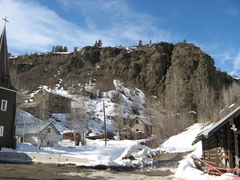
Turning west we started on the 110km or 70 miles drive over gravel road to Telegraph Creek. As the name implies this town was at one point a way station for the telegraph system in Northern BC.
For over half of its length the road was a typical forest road, wet, but otherwise in good condition.
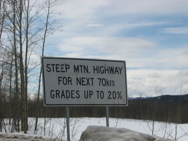
But the typical bit ended abruptly with a sign that said - beware road has steep grades of up to 20%. And sure enough not long after we found ourselves creeping down a series of steep (18% grade the sign said) gravel switch backs to a bridge over the Tuya River. Not long after we were presented with another series of switch backs this time the grade was 20% down into the valley of the Stikine River.
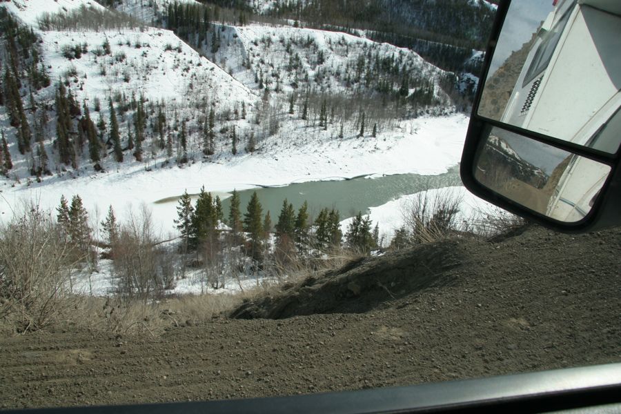
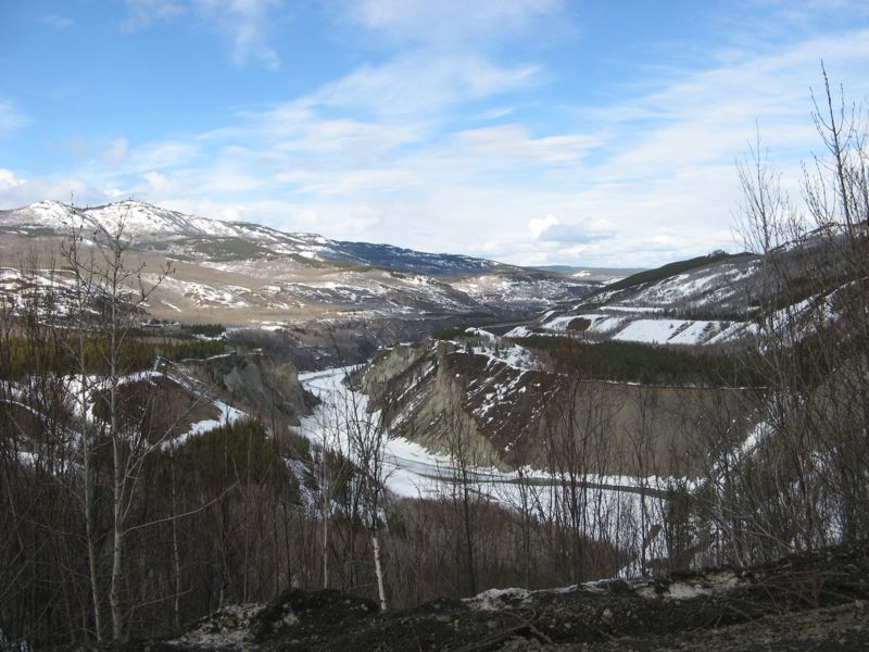
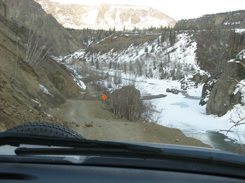
A few miles further on we traveled along a rock peninsular about 100 yards wide with the Stikine river about 400 feet below on the left and the Tahltan river 400 feet below on the right. At the end of the peninsular the road entered another series of switchbacks down to the Tahltan river bridge and a first nation summer fishing village. The climb out of this valley was, if anything, even more spectacular than the descent. Just to make it more interesting we were confronted with an oncoming pickup truck on one of the narrow sections of the ascent.
Much of the remainder of the journey into Telegraph Creek followed along the edge of Stikine river valley which was now an impressive gorge.
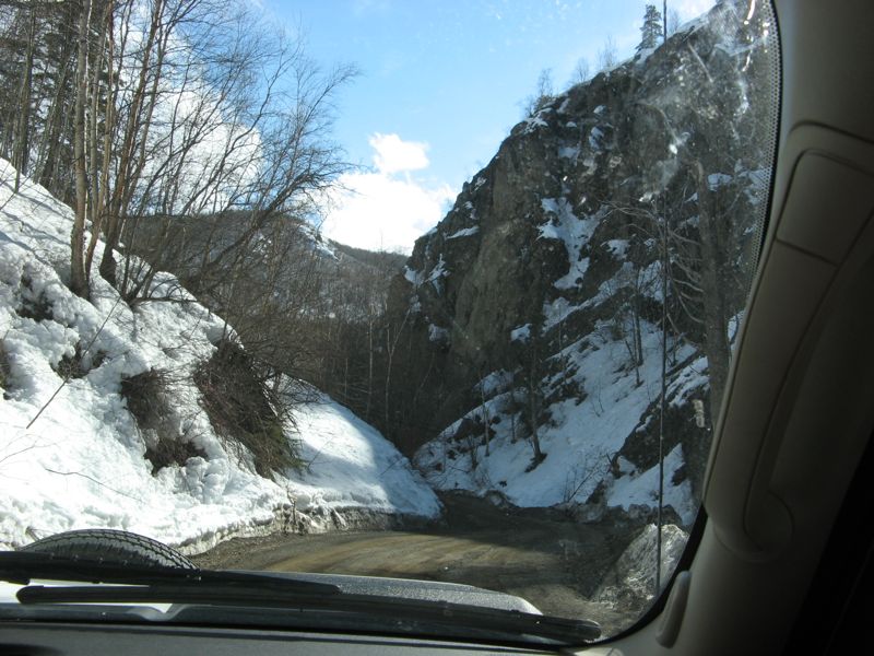
Telegraph Creek is now in two parts, the new town where the current residents live is on the top of gorge, but the old town is at the bottom of the gorge right beside the river so it could, in past days, be serviced by steamboats that traveled the river. The drive from new town down to old town is in keeping with the roads we had travelled over to get to the town in the first place -Steep.
I sometimes feel like I over use the word spectacular when writing about our travels but no other word works as a description of the Telegraph Creek road.