Overnight it snowed a few inches so this morning the world looks clean in the bright sunshine and blue sky. Unfortunately the water system froze up overnight and the pump is leaking again. So until we get to Fairbanks we will be using water from a 5 gallon plastic container.
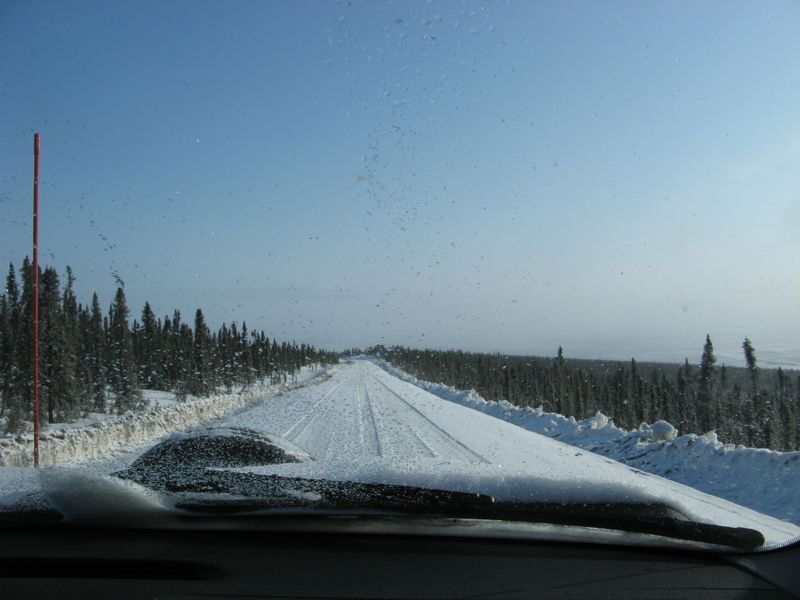
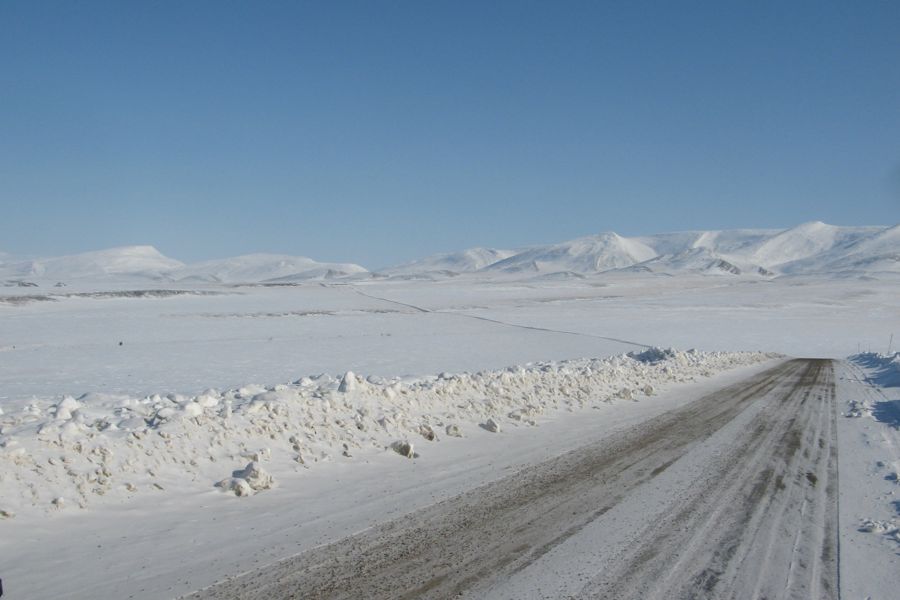
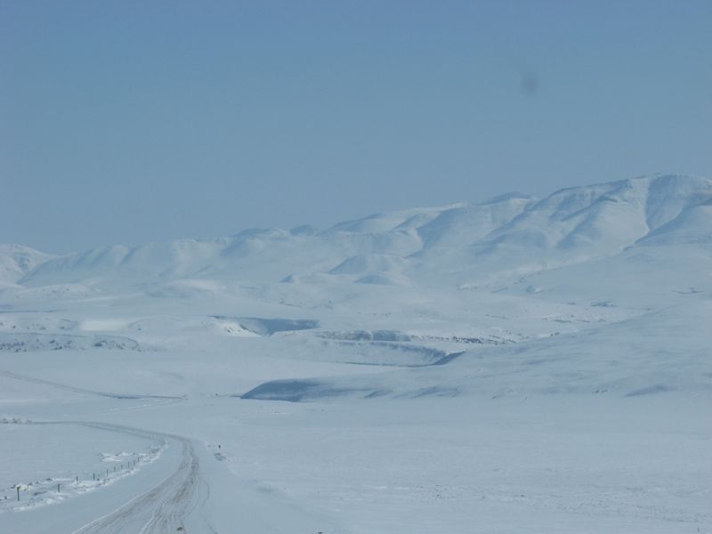
Once we got underway the day turned into one of those memorable highlights that you hope you get a few of on any trip. From Eagle Lodge the road climbed onto the ridge tops of a series of rounded hills and traveled above the tree line. The temperature was 5-6°F so the road was hard with occasional drifts of fresh snow covering the road. The views were stunning. I felt like we could see forever, and in every direction there were huge round topped mountains completely white with fresh snow. Eventually the road descended into a series of wide valleys, still above the tree line and still with stunning views.
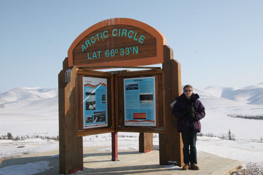
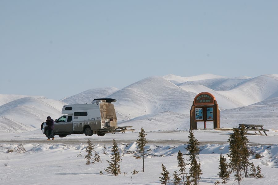
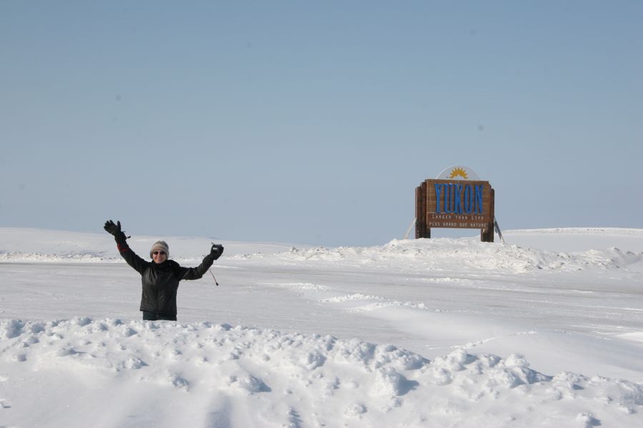
The first milestone of the day was crossing the Arctic Circle. There is a monument and a rest area to mark the spot; it was 5°F as we pulled in beside the monument to take a few photos.
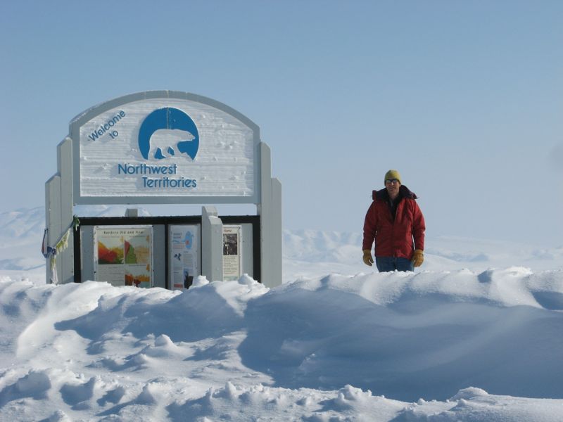
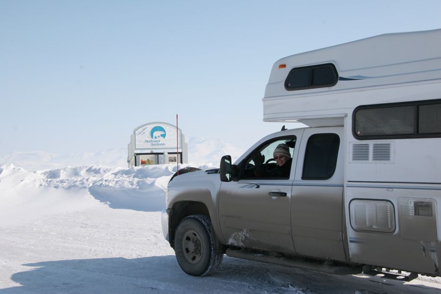
A little later the road climbed a steep hill to a saddle between two valleys and crossed the border between the Yukon and Northwest Territories. Again there was a rest area with signs to mark this transitions; it was 3°F this time when we stopped for photos.
Within 10 kms of entering the Northwest territory the temperature fell to -3°F - that's the coldest temperature our Tiger motor home has ever seen - also the coldest Nina has ever seen.
The scenery of broad tree-less valleys, a narrow frozen road with periodic snow drifts across the road continued until the crossing of the Peel river - the first of todays ice bridges. The Peel is narrow - maybe 600 yards wide, and the ice was much lower than the river bank so that road descended steeply as it became frozen river. The crossing was a bit of an anti-climax. We were onto and over and off before we really noticed.
After the Peel the conditions changed. The road is at a lower altitude traveling through the valley of the MacKenzie river, temperatures are higher - 10°F, the land is flatter, and there is a forest of stunted spruce trees on each side of the road. There was a lot more traffic much of it large trucks carrying earth for some reason. The heavier traffic seems to have caused the road to warm up as it is now muddy. After about 60 kms the truck traffic stopped and the road was again frozen with periodic snow drifts; but the land is still flat and the spruce forest continued.
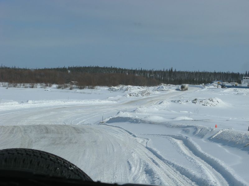
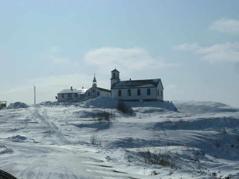
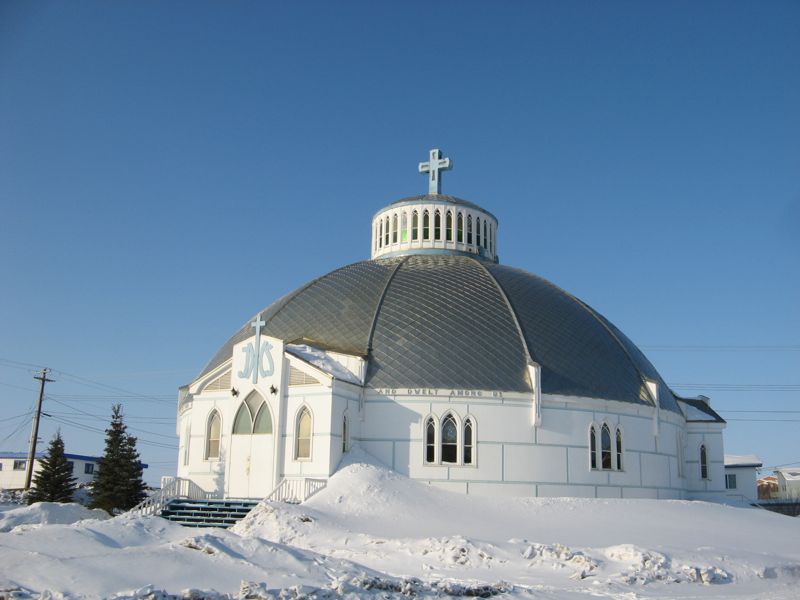
The crossing of the MacKenzie river, our second ice bridge, was something to see. The river was wide, maybe a kilometer, and crossing it took a few minutes, at least, so that we could not help but notice it and experience being in the middle of a river. To add to this right in the middle, there was an intersection and a side road went to a local village. Nina of course insisted that we take the detour to the village to look at the church. The road across the river really was ice, with a bit of snow cover. Hard to walk on but it did not seem too difficult to drive.
Once over the river the road continued 130 km through undulating country and stunted spruce forest all the way to Inuvik.
Its 10:00 pm and still bright outside. Its cold, 8°F, clear and gorgeous.