
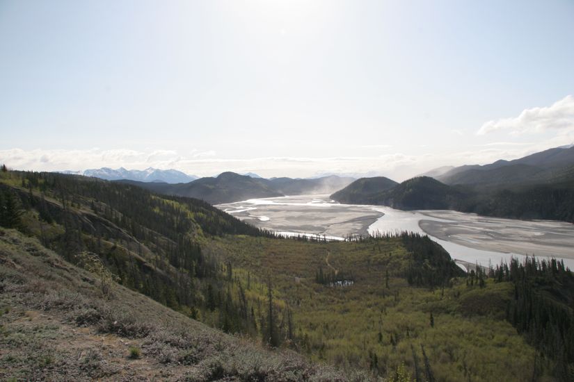
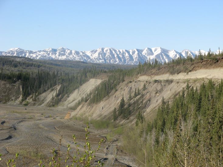
From our camp in the bed of the Copper River the McCarthy road climbed along the face of the valley wall over recent small rock falls to a ridge between the Copper River and the Chitina River. From this vantage point we could see east and south into the Chitina where the river meandered through a very wide valley. In the distance the valley was full of dust haze whipped up by the wind.
The road was originally constructed as a railway track for the copper mines at Kennicott. It looks like not much remaking was done when it was turned into a road as at intervals along the road, railway ties and sections of railway track can be seen embedded in the surface of the road.
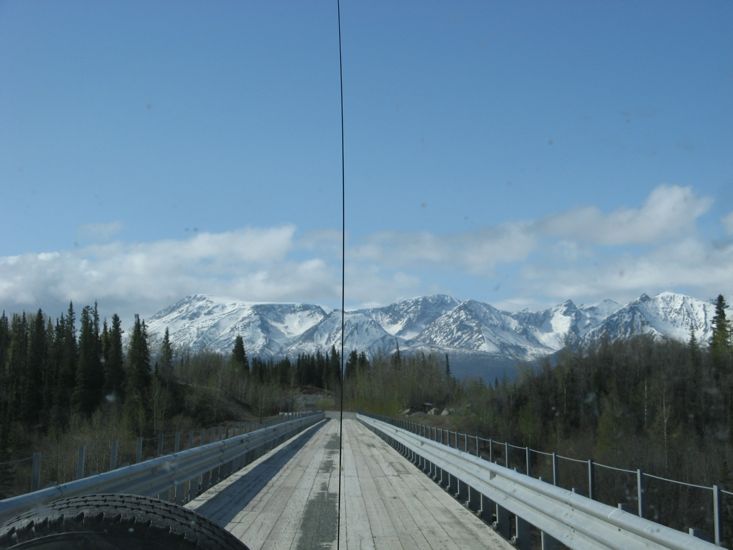
After the first few miles the road became somewhat tedious traveling generally through spruce or aspen forests, occasionally with great views of the mountains but often with not much of a view at all. It was also rough, the roughest we have been on so far. We travelled at 20 mph most of the time with many sections demanding that we crawl.
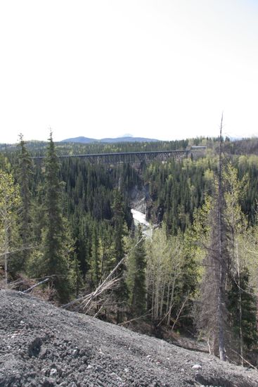
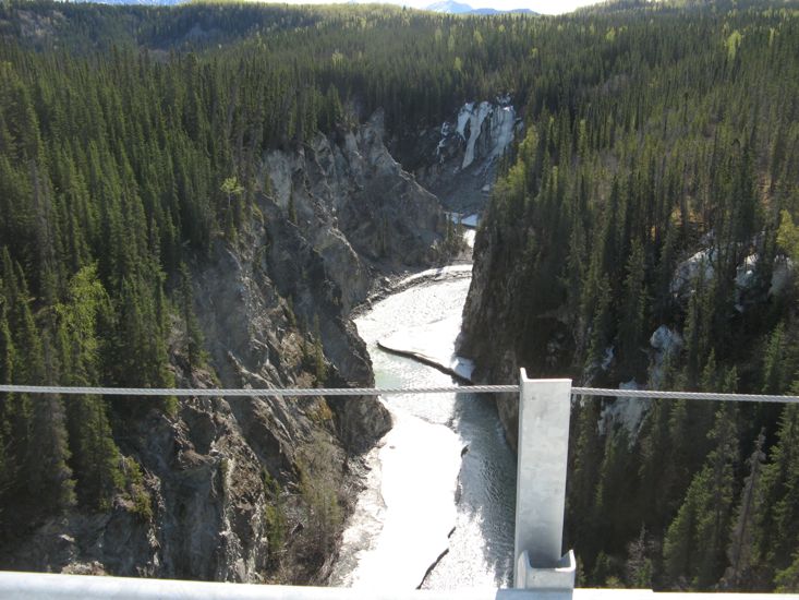
At mile 17 the bridge over the Kuskulana River was certainly one of the more notable points on the road. This single lane bridge, originally built in 1910 for the railway, was rehabilitated in 1988. It is 525 feet long and is suspended 238 feet above the swirling waters of the Kuskulana gorge.
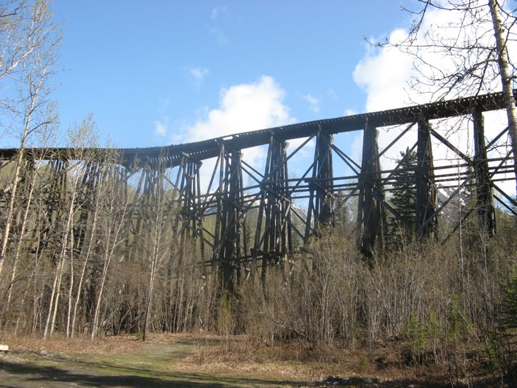
At mile 29 we passed the remains of an old railway trestle bridge across the valley of Gilahina River.
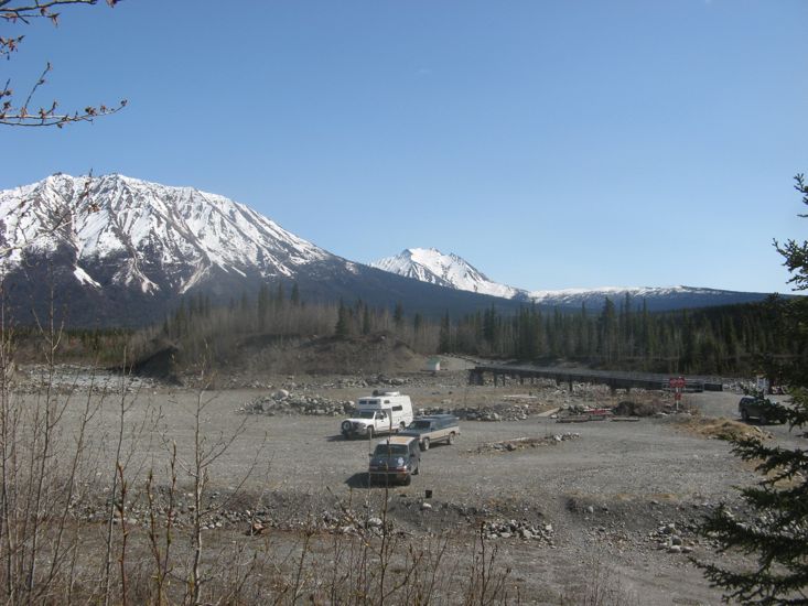
At the end of the road we found a parking lot. There were a few lodges or B&Bs scattered in the forest but they were hard to see, so that it felt like we had traveled 60 miles to see a parking lot. Next to the parking lot was a foot bridge over the Kennicott River and a sign indicating that the town of McCarthy was 1/2 a mile farther on. From our reading we knew that the town of Kennicott and the old mine site was a further 5 (or 6 or 7 depending on which guide one was reading) miles.
While we where having lunch and deciding what we might do a man on a 4 wheel ATV turned up and we got talking. He was visiting from Anchorage, was staying at one of the lodges and had borrowed the ATV from the lodge. He informed us that all tourist facilities were still closed and that the shuttle service that generally took tourists to Kennicott was not operating yet.
After a failed effort to rent an ATV from a local lodge - no one was home - we decided to walk the 1/2 mile to McCarthy and see what was there.
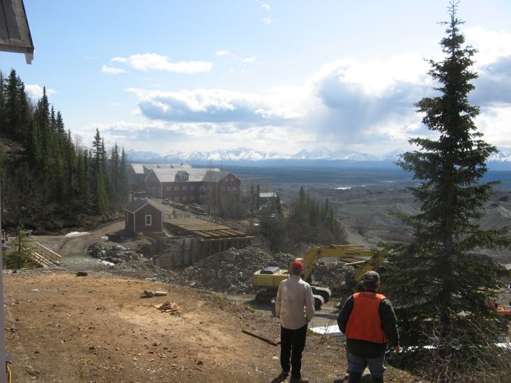
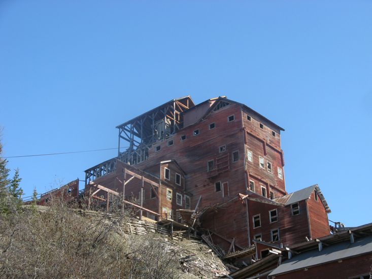
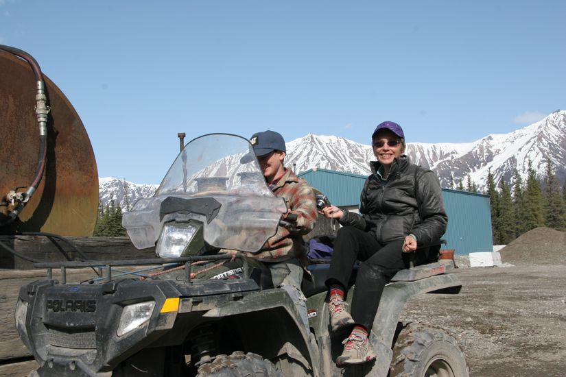
As we entered McCarthy we came upon a group with 3 ATV's at a small church building. We greeted them with could we convince one of you to become a taxi service for a little while?. In a flash we had our very own ATV and driver, turned out to be a 9 year old boy named Jubal. We spent the next 2 hours with Jubal and his machine. He drove us up the road to the old town and mine site, introduced us to many of the local people working at the site (they are employed by the National Parks to renovate and stabilize the old buildings), and with his friend Calin gave us a tour of the town. Jubal's father seems to be in the road and bridge business and owns one of the two bridges across the Kennicott River.
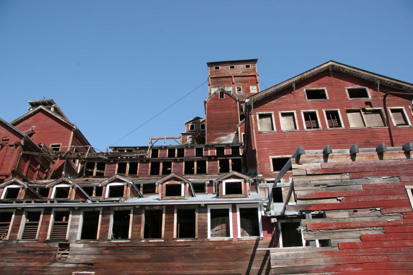
The town of Kennicott is situated atop the southern moraine wall of the Kennicott Glacier and was the site of processing plant for the Kennecott copper mine - note the spelling, the town and glacier are Kennicott the mine is Kennecott. The guide book says this is a result of a spelling error when registering the mine.
After the tour of the town Jubal deposited us back at the parking lot after a detour to refuel his ATV at the family machine shop and gravel pit. Finding Jubal was a real stroke of luck for us for otherwise we would have seen none of the old town. Our thanks to Jubal for his graciousness, good driving, and the informative tour.
Back on the road we made the slow drive back to the Copper River bridge to once again camp on the pebbles of the bed of the Copper River.