We spent a considerable time this morning trying to get water to top up the Tigers water tank. At the campground we tried a number of options to fill from their water tank but there was not enough pressure to do the job. After further investigation we were directed to the town water plant that fills tankers for household water delivery, again no luck - this time they did not have a hose small enough for us. Only 2 inch diameter hoses for filling the trucks. So we eventually gave up on the water.
Next on the list was wifi - this proved to be problematic also. The only cafe in town did not have its wifi working so eventually we found the library and got it.
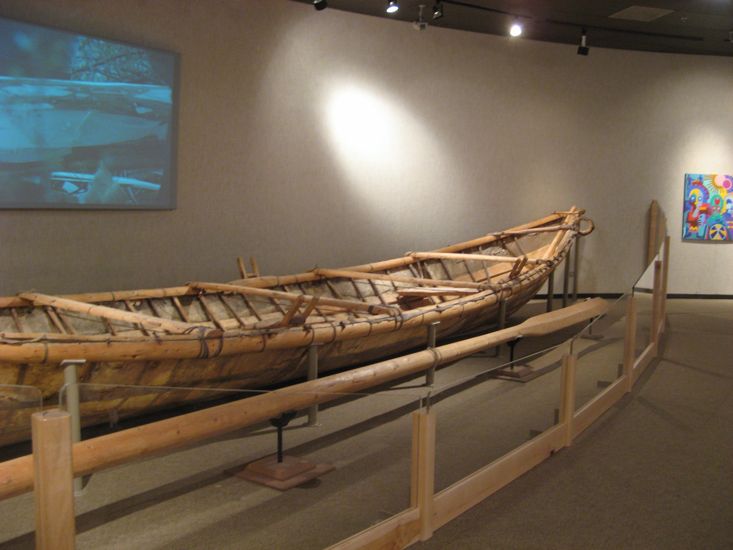
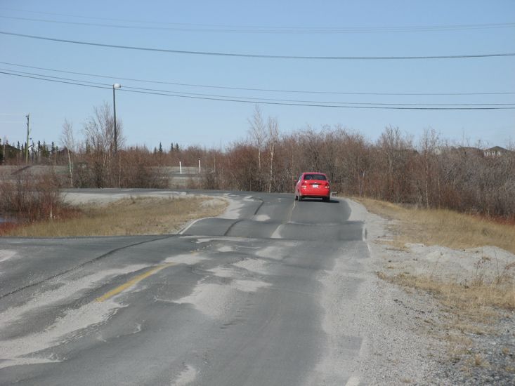
The Prince of Wales Northern heritage Center had some interesting exhibits on local culture and nature, including a particularly interesting film and display on the construction of a moose hide boat. The parking lot and access road also proved interesting - they had some of the largest frost heaves we have yet seen - the pictures unfortunately don't do them justice. Please note that the road with these heaves is also the access road to the Northwest Territory Assembly Building.
After collecting some groceries we headed out of town along the Ingram Trail. This is a dead-end road that heads a little North of East out of Yellowknife past a number of lakes, territorial parks, ice roads entrances, and lots of cabins generally perched on top of a round hump of granite. I found out today that Canadians describe the landform as Canadian shield - a large expanse of granite in the form of irregular humps with swampy vegetation between the humps.
We stayed the night at the end of the Ingram Trail in a rough camp site.