
We were away early this morning heading for the mountain town of Caraz in the valley that lies between the Cordillera Blanco (snow covered) and the more westerly Cordillera Negro (not snow covered) mountain ranges. The route we chose travelled down the coast to Chimbote, then headed inland along "highway 12" through Huallaca, and the Canon Del Pato.
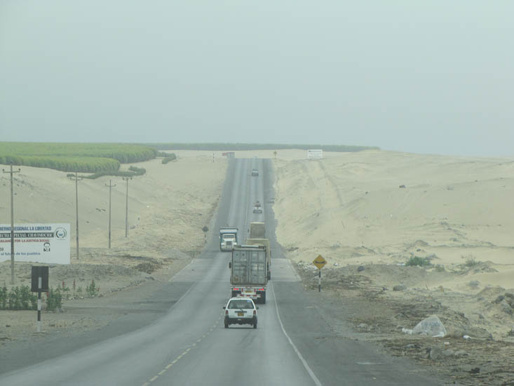
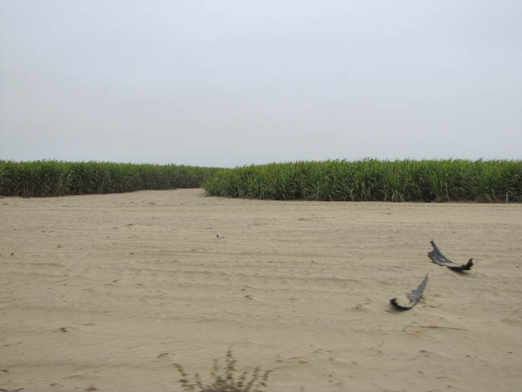
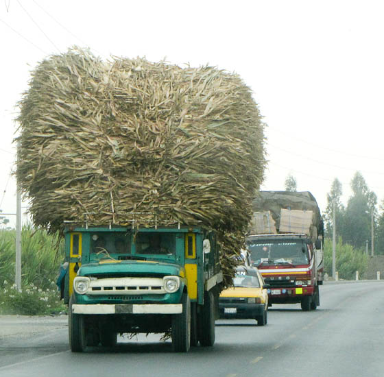
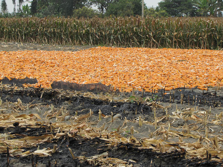
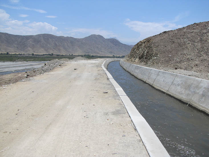
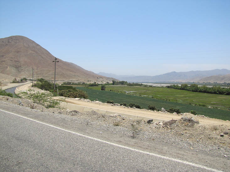
The coast section of the journey continued to be an unusual mix of desert and intensive agriculture with large stands of corn and sugar cane growing in sand. Turning inland at Chimbote the land was less sandy and agriculture continued now with frequent rice paddies. Up to the town of Chuquicara the road followed beside the Rio Santa and was paralleled by large irrigation canals. That explained for us how to grow crops in sand - a lot of irrigation.
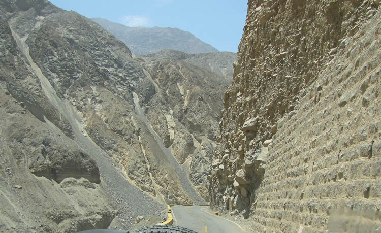
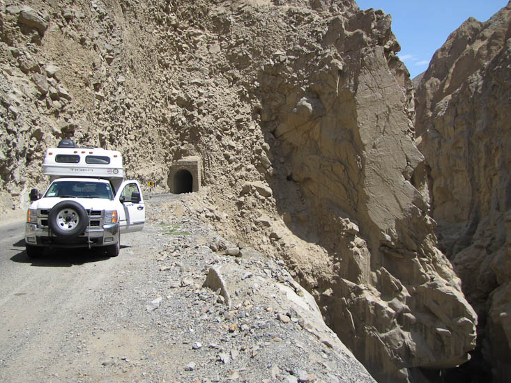
At Chuquicara we made a navigational mistake, though we would not realize this for a couple of hours. After a short chat with the National Police guard in the town we took a left turn just after the town over a bridge and into a side valley. We took this turn because it was the sealed road, the straight road was gravel. This side excursion turned out to be very impressive. The road climbed along the side of an ever narrowing river valley until at its narrowest point it was less than 50 yards wide. To get past this point the road had to burrow into the cliff through a tunnel.
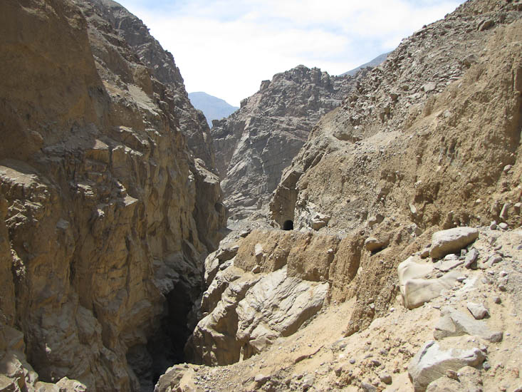
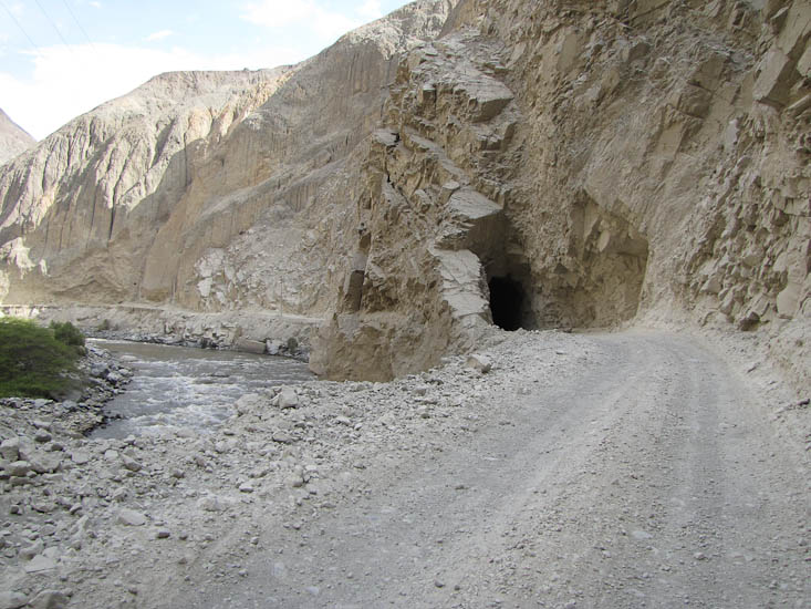
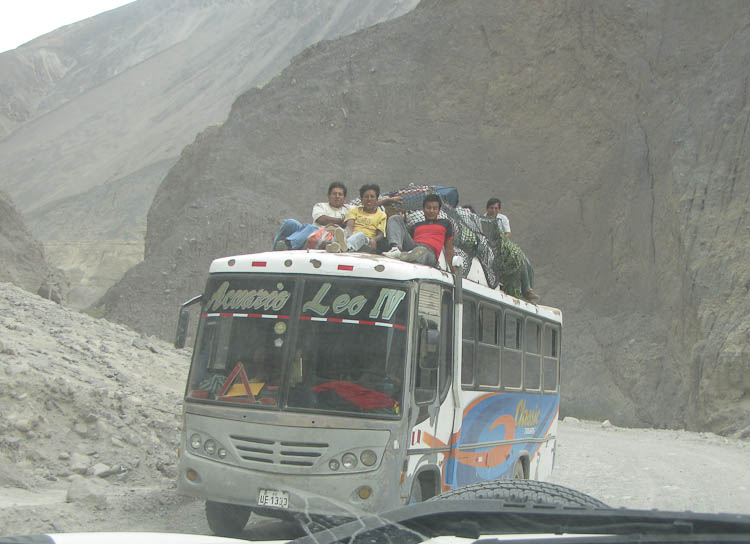
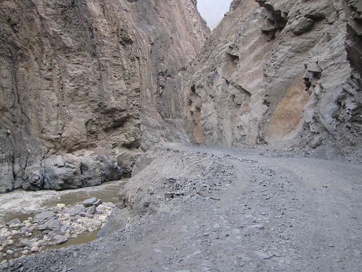
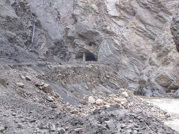
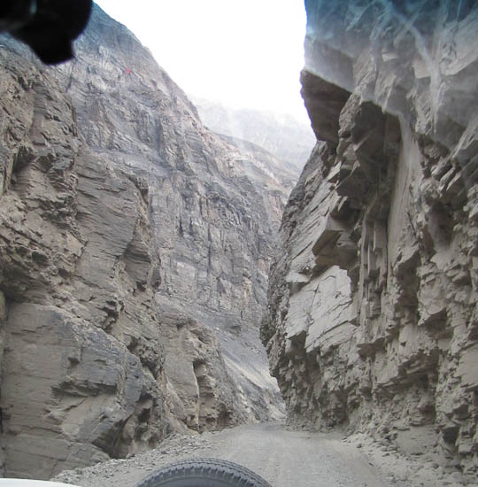
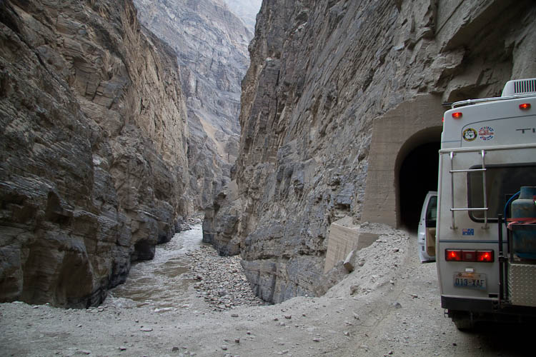
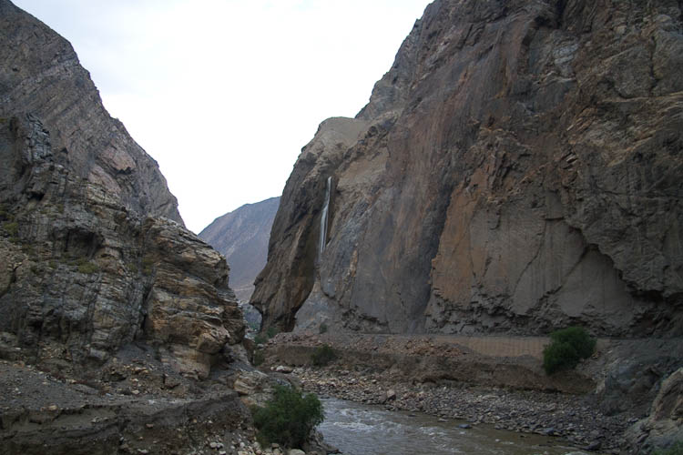
Eventually back at the turnoff we got onto the correct road. This was confirmed a few minutes later as a bus went by us heading back to Chimbote. That was close to 2:30pm. The next 4 hours and 30 miles would take us over some very rough rock, mud, gravel roads and through an amazing canyon. The first 20 miles the road clung to the side of one river valley after another occasionally crossing on narrow steel bridges. We passed a number of buses, families farming in the incredibly dry soil, we came across small villages with lots of fresh vegetables and fruit, and men just standing in the road talking. About 5:00 we passed an old coal mine, and a particularly dirty settlement (black coal dust everywhere); we almost failed to see the old man sitting in a wheel barrow beside the road he was covered from head to foot in black coal dust. Around a corner from this settlement we could see the valley narrow; down to 50 yards, and the road bypassed this narrow spot through a tunnel. Over the next hour we passed through 7 or 8 rough tunnels that allowed the road to continue along the side of the valley. There was perhaps a 5 mile section where the valley walls were vertical, maybe 2000 ft high, and the road was literally scooped out of the walls, some times in the form of tunnels and some times just narrow ledges with rock hanging over head. We thought for a while this was the Canon Del Plato, but a check of the map and guide book cleared up that misconception. Del Pato will come tomorrow.
Eventually the valley widened and we were able to find a place to pull off the road where there appeared little danger of falling rocks hitting us during the night.
Once through the narrow parts of the canyon, about 25 miles from Chuquicara, there were a limited number of places to get off the road. We picked one just before dark.
If you plan on driving this road, and we suggest you do, make sure you are not in the canyon late in the day (like we were). It is so spectacular that one needs time to stop, look and savor it.