
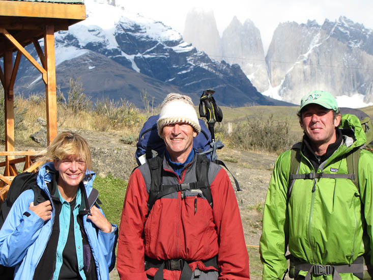
For the past 4 days I have been hiking with our friends Sam and Bernie on a trek called the W in Parque Nacional Torres del Paine. Nina (and Max a temporary traveling companion) drove with us to the park entrance about 90 kms from Puerto Natales on Sunday morning the 31st January and dropped us where a shuttle bus took us the last 7 kms to the start of the hike. Thereafter Nina and Max drove the Tiger back to Puerto Natales where they stayed while we were on the hike - unfortunately her foot is not up to hiking. Max is acting as guardian of Sam and Bernie's vehicle.
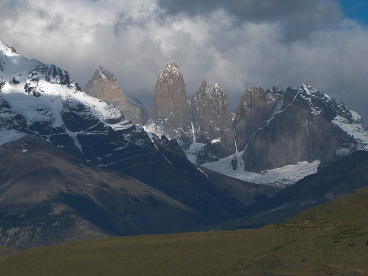
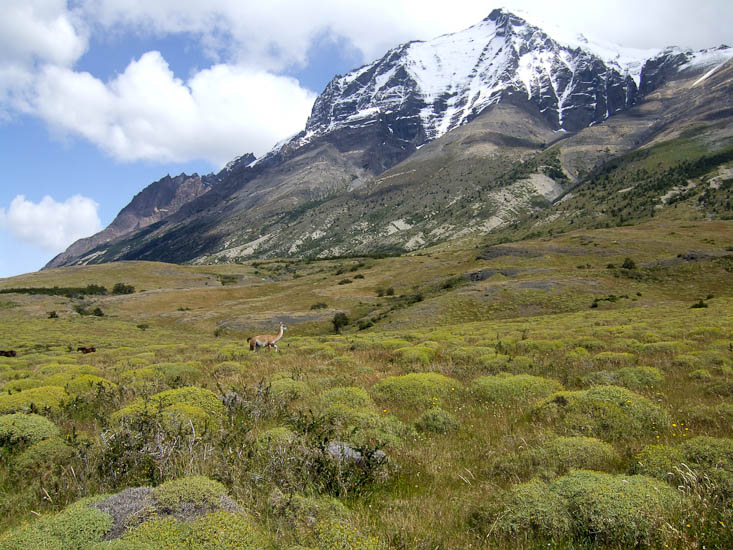
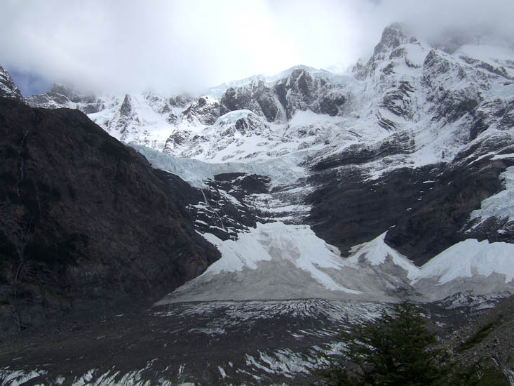
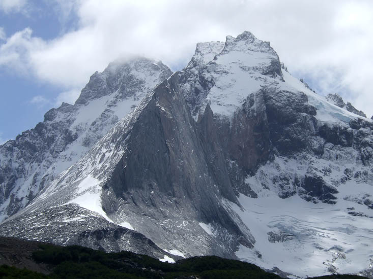
The weather was not bad as we approached the park so we got some good views of the rock pillars or towers (Torres) after which the park is in part named. The Paine part of the name comes from a local indian language and means "blue" - over the next few days we would come to guess that the "blue" part of the name comes from all the blue ice in the many glaciers we would see.
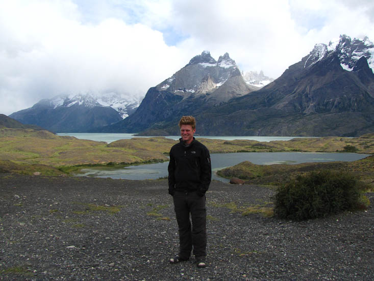
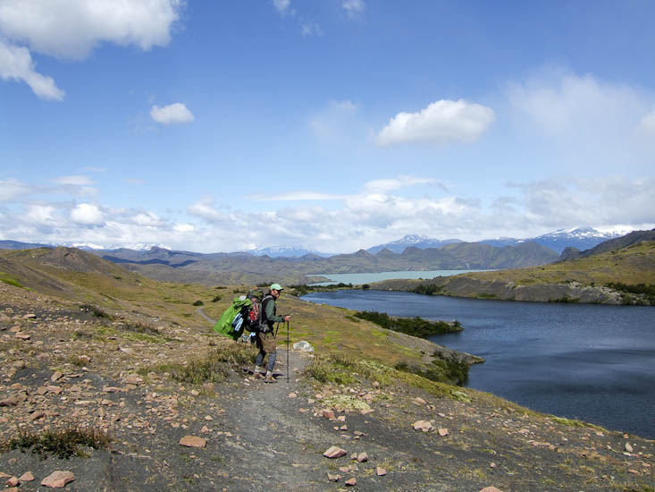
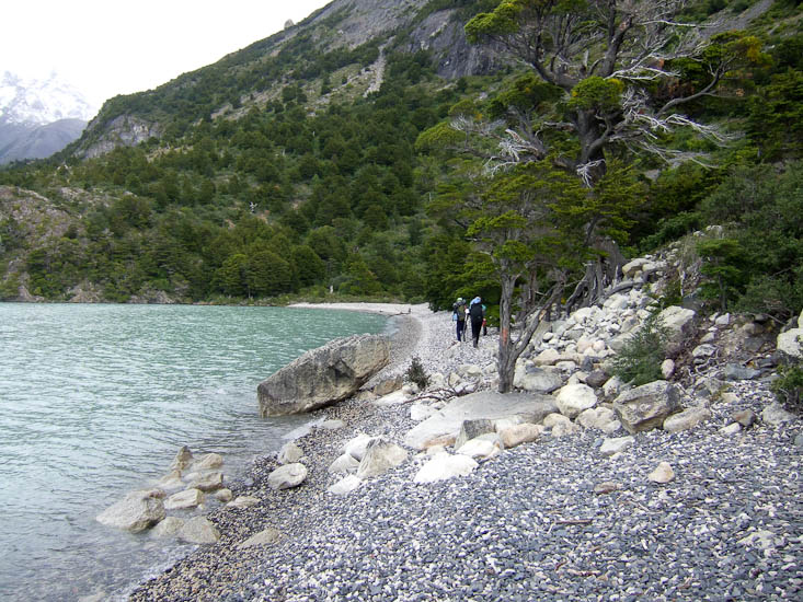
The hike is called the W because the hike consists of a track beside a lake (the base of the letter W) and three vertical legs that climb up into valleys or rivers that feed the lake. So it is a sort of crude W shape when viewed on a map.
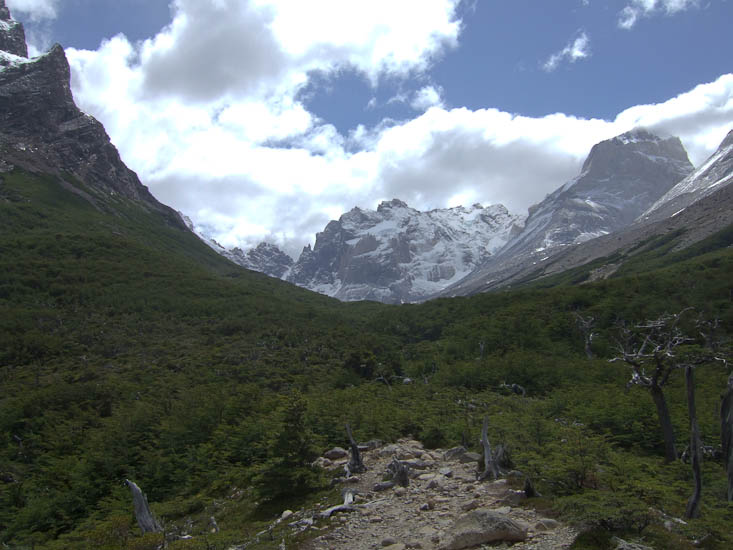
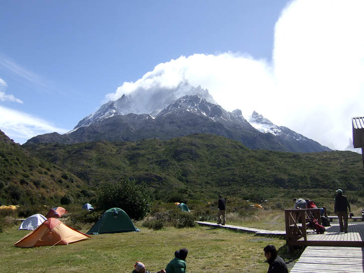
The hike is very popular with some 200,000 visitors a year and so we could not call this a solitary wilderness experience, but none the less we got some great views of mountains, lakes and Patagonian steppes, as well as some much needed exercise. Though if it was exercise I was after I would have chosen a more gradual introduction. The first 9 kms of the trail climbed 500m and had my legs quivering with fatigue; as I told one of my companions, the most vigorous exercise I have had in the last 10 months is pushing on the brake pedal in the Tiger; and I haven't hiked with a pack this heavy in 15 years.
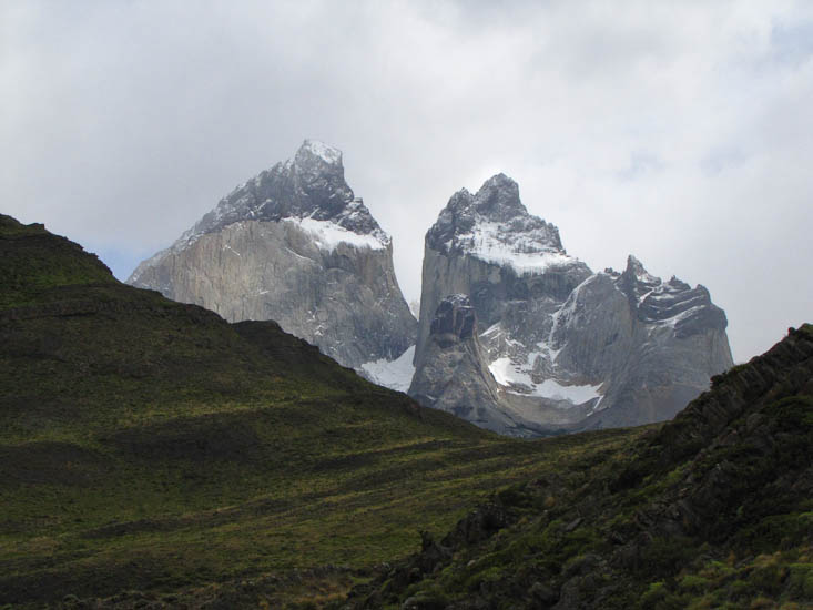
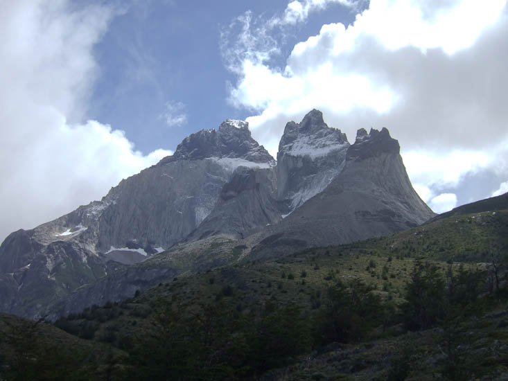
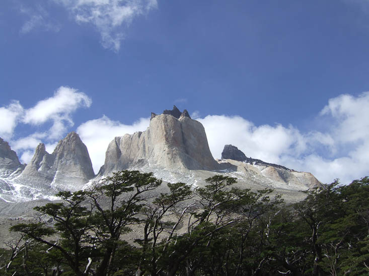
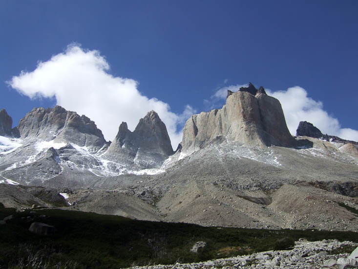
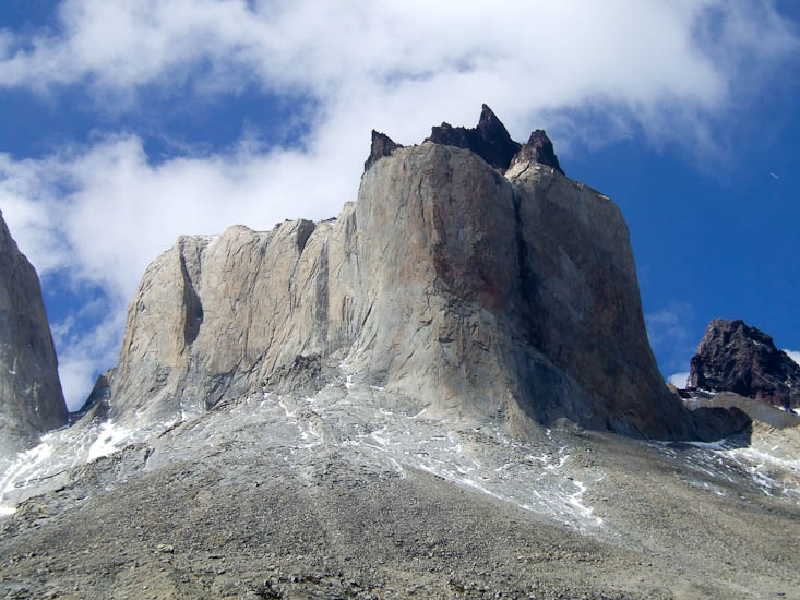
The highlight of the hike for me was the afternoon of day 3 when I hiked into the upper reaches of Valle Frances in fine weather and had some spectacular views of the Cuernos (or Horns); these are stone towers that have near vertical sides made of light colored granite topped with craggy brown sandstone. They look like a crazy chocolate covered cake.
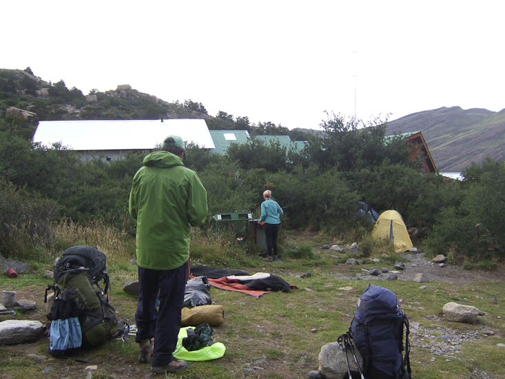
Much of the hike was in open country (Patagonian steppes) rather than forest and so we were pleased to have reasonably sunny weather. This would be an exceedingly uncomfortable hike in bad weather. The designated campgrounds along the trail are showing the impact of the large numbers and are in need of better rubbish collection and better toilet facilities.
I decided to skip the last upward leg of the W that goes to a lookout from which the apparently spectacular Gray Glacier can be seen and returned to Puerto Natales a day ahead of schedule. My left foot (broken badly some years ago) was beginning to hurt.
Irony of ironies I arrived back to find that Nina and Max had taken a tour that same day to see Gray Glacier and were raving abut the sights as well as the scotch they were served with 1000 year old glacier ice for breakfast.