
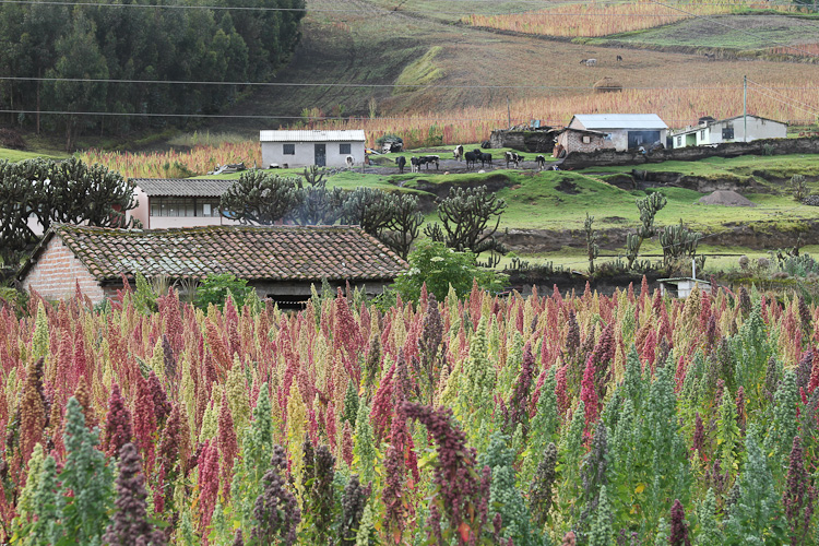
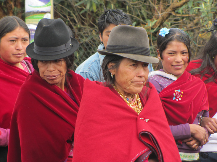
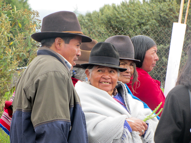
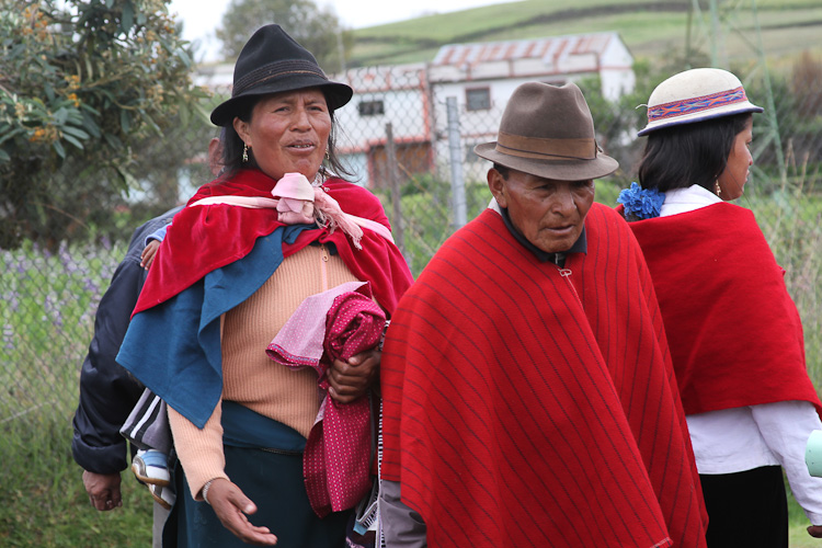
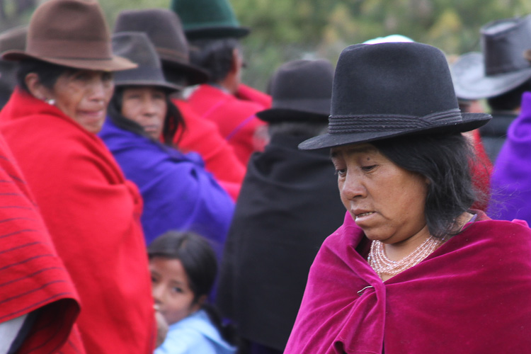
This morning we stopped at the town of Colta for a break. We had been looking for a place to stop for some miles when we came upon a road sign indicating a picnic area ahead. The sign was quite a surprise, signs are not common and official picnic areas even less so. But the place was even more of a surprise. A large very elaborate park with gardens, decorative bridges, children's play equipment and rest rooms was set beside a nice lake. The surprise continued. The place was swarming with people, adults and toddlers in traditional dress and children in school uniforms. After a while it became obvious that some kind of parade was going to take place and we stayed around long enough to see everyone line up and start marching east into the town center that was a little way removed from the highway and park. The banners being carried by the marchers indicated that the 28th anniversary of something was being celebrated.
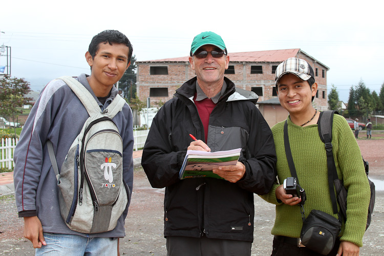
After the marchers departed we walked around the park and got into conversation with a couple of young men who, it turned out, were at the park to complete a home work assignment. They had to take a video of themselves reading (in English) a short speech on the local tourist attractions to some tourists. We were soon the tourists in this amateur movie making exercise and also English tutors (as they wanted us to correct the English in their speeches). After all this we gave these guys a ride about 20 km up the road to Riobamaba. It was interesting to listen to these young men read their English speeches - even though we knew what was to be said it was hard to recognize it through their accents - it gave us a better understanding of why the locals often fail to understand our attempts at Spanish.
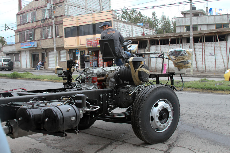
In Riobamaba we stopped for a look at a workshop making buses. Parked out the front of the workshop was a brand new rolling chassis - that is all the parts of a bus except the body. While we watched a workman drove the chassis into the shop so that construction could start. During our journey we have seen a number of these chassis being driven along the highway but this is the first time we have had a chance to get a good photograph.
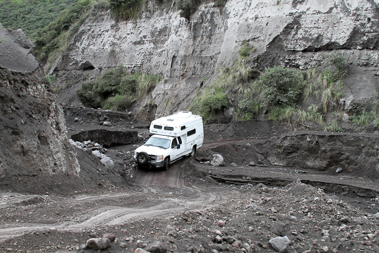
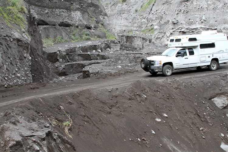
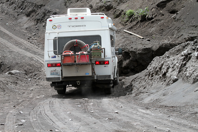
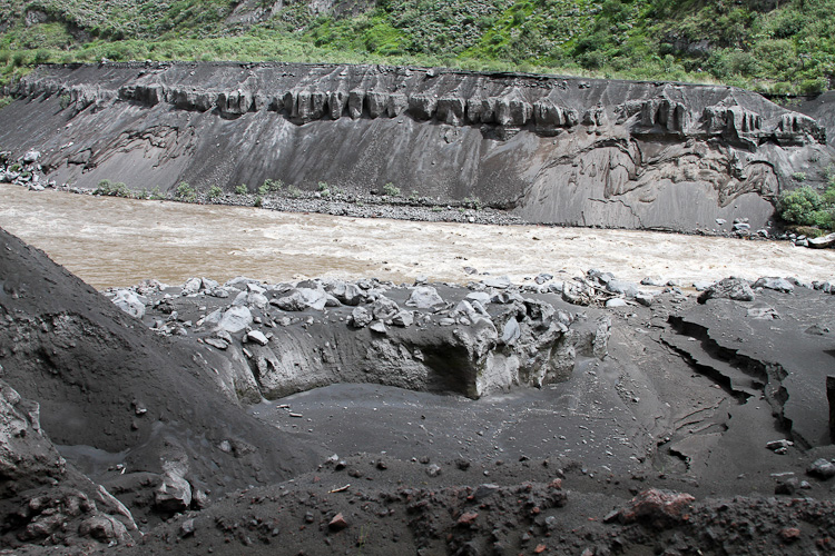
From Riobamaba we were headed for Baños - a resort town with hot spring baths. From the map we selected a secondary road that looked shorter than the highway, but for some reason (that we would later discover) our GPS did not want to take us by that route. But we persisted and drove for about 40 km to the town of Penipe, along the way we saw a number of signs to Baños and so assumed our navigation was all under control. However a few km after Penipe we got the first signs that something was not right - the edges of the road had been engulfed by tall grass and scattered rocks covered the road surface. A few kms more and the road turned to sand. But we persisted as we could see from the vehicle tracks that traffic had used the road recently. A few more kms and the road narrowed and dropped steeply down towards the river that we had been following. Over the next few miles we negotiated 3 very narrow sections where the road had been washed away and had been rebuilt with some boulders and sand. These were the most difficult road sections of the entire trip and definitely required 4x4, and some tricky maneuvering. Unfortunately we eventually came to a place that we could not pass and had to turn around and go all the way back to Riobamaba and take the main highway - the GPS was right all along.
Just as an aside - the GPS map of Ecuador we are using is new. I found it free on the internet only recently, last time we were in Ecuador we did not have a GPS map.
We splurged and stayed at the Sangay hotel. It's a short walk from the main square, has secure parking, and rooms ranging from $50 (+22% tax) for a double.