
The simple statistics of todays road journey are impressive, if more than a little frustrating.
We climbed 2000 m in 20 miles, descended 1000 m in 10 miles, spent 6h 36m on the road, of which 2h 14m was moving and 4h 21m stationary. At the end of (what felt like a full) day of driving we had covered 56.9 km.

Now I will fill in the story a little.
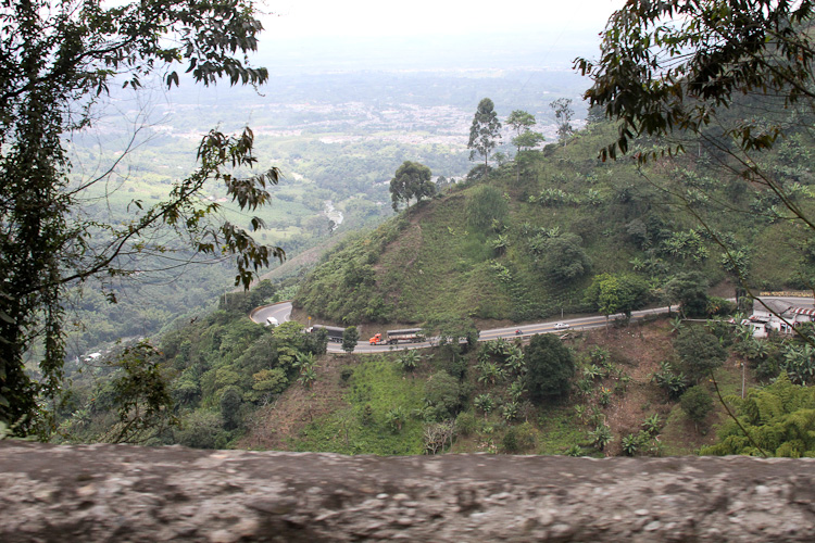
After fueling up and reseting the GPS on the Armenia bypass, we commenced the climb out of the Armenia valley. This is truly an impressive and dangerous road. It is a narrow two lane black top that (as noted above) climbs 2000 m in 20 miles. Some of the turns are so tight that the downhill traffic stops to allow uphill bound 18 wheel trucks to negotiate the turns. There are no guard rails and no passing lanes. If not for some dare devil overtaking this road would easily turn into a procession of vehicles following the slowest vehicle up the hill. But despite the narrow road, no straight stretches and limited visibility, faster vehicles do indeed overtake slower vehicles. They simply wait until they can see to the next corner and then pull out and creep past the slow vehicle. In the event (very common) that an oncoming vehicle appears while this maneuver is underway, the oncoming vehicle slows down, maybe even stops, and squeezes over.
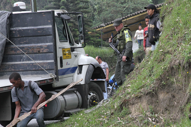
Mid way through the climb we came upon a line of stopped traffic and after waiting a little while Nina went to investigate what the hold up was. It seemed that an uphill bound 18 wheeler had decided to change a flat tire in the middle of a sharp right hand corner. A downhill bound 18 wheeler had tried to squeeze past on the outside of the corner but could not fit, and was now parked beside the truck changing the tire. There was a little space on the inside of the corner and another large truck and trailer was trying - unsuccessfully - to squeeze through that gap by driving up over the curb. Eventually sanity prevailed. The army stopped the truck trying the gap on the inside, made him get out of the way and allowed uphill bound smaller traffic to pass. Though all downhill traffic was still blocked.
After that we stopped a number of times for short periods for road work that was taking place.
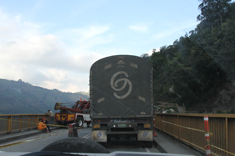
After the summit, some descending, and more road works we came upon another stopped line of traffic. We tagged on the end and waited patiently, it was around 1:00 pm. A little later we made lunch - still parked in the line of traffic. Every so often the line would move a little. Around 4:00 the line had advanced enough and we entered the town of Cajamarca. By 4:45 our place in the line had advanced to a bridge, over a very deep and steep river valley, that provided the exit to the town. This bridge was the impediment to traffic. The police were only allowing one 18 wheeler on the bridge at a time. One lane of the bridge was blocked by a large tow truck, the cable from the trucks winch descended into a hole in the surface of the blocked lane. There was a large oil spill on the bridge under the tow truck. But other than these observations we had no idea what was going on. Once over the bridge we were back up to normal (twisting mountain) speed. The oncoming traffic waiting to cross this bridge formed a line at least 5 miles long. They would be there for many hours.
We found an old section of highway that had been bypassed by a bridge and pulled in. During the night a few locals walked past on their way to somewhere but no one bothered us.
About 6:00 am the next morning as we were preparing to leave an army patrol turned up. We did not really understand what they were telling us but it seemed that this area was still somewhat dangerous and they made gestures like bombs exploding. They stopped traffic on the highway so we could exit the side road and we were on our way.
A better choice would have been a few miles farther along the road where we could have parked near the army control post.