Birdsville
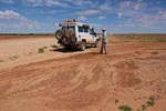
The drive today of nearly 400km to Birdsville was in some ways interesting, in some ways boring and uncomfortable. The road was about half sealed and the gravel half was in good condition. The route is generally flat with long stretches of straight road. It was hot, 33°C, and the flies were pretty intense. That's the boring half.
The interesting half was the landscape and the change of land forms one experiences along the way.
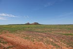
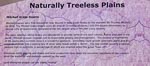
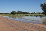
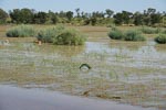
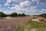
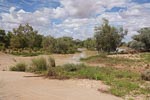
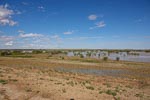
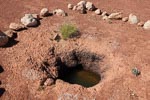
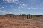
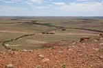
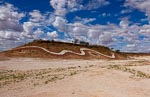
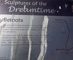
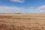
The drive started in Channel Country and for the first 100+km the land is flat and very green due to recent flooding and the evidence of flooding was everywhere; including many spots where there is still water close to the road. As we found out at a rest stop this is Mitchell Grass Down (read about it in the second image in the first set of images). The abundance of water from recent floods can be seen in the last image of the first set where a hole in the surface rock of less than half a meter deep gives access to the water table.

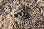
The first indication that we had arrived was the Birdsville Race Track. Nina found the nest with 2 eggs while getting photos of the race track.
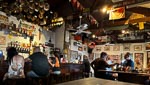
Birdsville is pretty quiet, only a few groups in the camping ground, maybe 20 people in the pub at drinks time. We have deduced from conversations here and in Windorah that the tourist season has been delayed a little by the flooding, and once it gets going there will be "hundreds" of people visiting these little outtback towns.
We will spend a couple of nights here in Birdsville and give ourselves the luxury of a campground cabin.