Posts for April, 2024
The Center of NSW (Nyngan, New South Wales)
Journal entry for Monday 1st Apr, 2024 (day 3, kms 235)
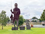
North of last nights camp we stopped in the very small town of Peak Hill and paid a visit to its now defunct open cut gold mine and the unusual sculptures of two miners panning for gold.
...click/tap to read the full postThe Long Paddock (Curraweena Rest Area, New South Wales)
Journal entry for Tuesday 2nd Apr, 2024 (day 4, kms 238)
When we woke this morning it was raining heavily so we were certainly glad to be housed in our nice cabin. Eventually the rain eased and we started the day of travel. First stop was a little tour around Nyngan, a look at the Coach House a display of wagons and other stuff from the pioneer days. At the same place is a very large statue of The Bogan a guy with a fishing pole. We guessed this name comes from the Bogan River on which the town is situated.
...click/tap to read the full postThe Darling (Louth, New South Wales)
Journal entry for Wednesday 3rd Apr, 2024 (day 5, kms 235)
After a short run into Bourke this morning we spent a few hours reacqainting ourselves with this town and its pivoltal role in the wool and shipping industry of the 1880s. Shipping!, thats right even though the town is nearly 1000km from the coast it was a major shipping port for the trade along the Darling and Murray River systems. In the town there is still a revived remnant of the dock used in this trade. In fact there are a number of towns we will mention and visit over the next few days that were founded mainly because of that trade.
...click/tap to read the full postA Little problem (Bulla Park Rest Area, New South Wales)
Journal entry for Thursday 4th Apr, 2024 (day 6, kms 254)
During her morning walk around Louth this morning Nina came upon the sign in the first photo and the ex-school teacher in her was horrified that the words on the second line were not spaced.
...click/tap to read the full postOpal Town (White Cliffs, New South Wales)
Journal entry for Friday 5th Apr, 2024 (day 7, kms 235)
This morning we spent some time exploring Wilcannia, another major port town from the days of Darling river shipping. The past importance of the town is depicted in the number of elaborate sand stone buildings. Today however, it is a shadow of its former self, with many closed shops and buildings for sale testifying to its decline. Even the supermarket is supported by the Federal government.
...click/tap to read the full postRain (Broken Hill, New South Wales)
Journal entry for Saturday 6th Apr, 2024 (day 8, kms 300)
This morning the sky was grey and there was a light drizzle of rain, but unfortunately that rain was enough to put paid to our plans of visiting a nearby National Park. In this part of the country rain often has the effect of closing gravel roads and stranding travelers. So we returned to Wilcannia for a few more photographs and then on to Broken Hill.
...click/tap to read the full postInland Sea? (Menindee, New South Wale)
Journal entry for Sunday 7th Apr, 2024 (day 9, kms 185)
Today we visited the Menindee Lakes which are 90+km south from Broken Hill. Like yesterday the drive was through barren countryside mostly of salt bush and hence it was a surprise to arrive at the complex of lakes that make up the Menindee Lakesand provide a home for an amazing bird population.
...click/tap to read the full postDarling River Weir (Silverton, New South Wales)
Journal entry for Monday 8th Apr, 2024 (day 10, kms 198)
This entry will make a little more sense with the following map of the Menindee Lakes complex.
...click/tap to read the full postTibooburra (Tibooburra, New South Wales)
Journal entry for Tuesday 9th Apr, 2024 (day 11, kms 359)
Today was simply a travel day. We needed to get to Tibooburra and that would be the longest days drive of the trip so far. Before starting I got a coffee at the Silverton pub and then we were on our way.
...click/tap to read the full postCameron Corner and back (Tibooburra, New South Wales)
Journal entry for Wednesday 10th Apr, 2024 (day 12, kms 290)
Our plan for this trip was to get to Birdsville via Tibooburra, Cameron Corner and Innamincka. However yesterday afternoon we discovered from the local roadhouse owner that we could get as far as Cameron Corder but thereafter all roads were closed. So today, hoping for a bit of luck, we setout on the 140km drive to Cameron Corner with the hope we could go farther but with the expectation that we would have to return to Tibooburra.
...click/tap to read the full postIsolated (Hungerford, Queensland)
Journal entry for Thursday 11th Apr, 2024 (day 13, kms 336)
A few more photos around Tibooburra before departing. The boat up in the air is a replica of the boat carried by Stuart's Expedition while searching for the fabled inland-sea. Can you imagine hauling that thing halfway across Australia only to never find enough water to get it wet.
...click/tap to read the full postOutback Hydro Power (Thargamindah, Queensland)
Journal entry for Friday 12th Apr, 2024 (day 14, kms 168)
A shorter drive today only 168km to the Queensland town of Thargomindah via another isolated dirt road, we only saw one other vehicle. The name Thargomindah comes from the local aboriginal language and means something like "cloud of dust", which seems appropriate given the terrain we have travelled through. The town is well setup for tourists with a tourist info office handing out maps and other info, a very well equiped caravan park, and even a marked route for a walking tour of the towns historic sites. Perhaps the most interesting historical fact about the town was that it was the 3rd town in the world to have electricity. The water from the local artesian bore comes out under high pressure and a creative local engineer realized that pressure could be used to drive a generator so in the mid 1890s the construction of a water powered electric generator was commissioned. It became operational on Sept 9th 1893.
...click/tap to read the full postFlood Diversion (Quilpie, Queensland)
Journal entry for Saturday 13th Apr, 2024 (day 15, kms 219)
Today was supposed to be a short day on a paved road; from Thargomindah to Quilpie (don't you like the names). However it turns out that towards the end of the drive the paved road was still under the waters of the Bulloo River (a major river in this area) and as a result there was a diversion of 40 or so km to bypass the problem.
...click/tap to read the full postChannel Country (Windorah, Queensland)
Journal entry for Sunday 14th Apr, 2024 (day 16, kms 249)
If you look at the right kind of map of South West Queensland you will see a region called Channel Country. It is an area where largish rivers like the Cooper, the Barcoo and the Diamantina break out into braids of creeks surrounded by flood plains. When the creeks flood (after the wet season in Norther Australia) the creeks overflow and the whole area turns into a temporary lake. Well today we got our first experience of Channel Country. As expected there were many many causeways over creekss and between those long stretches of low lands that were green and lush vegetation due to recent flooding.
...click/tap to read the full postBirdsville (Birdsville, Queensland)
Journal entry for Monday 15th Apr, 2024 (day 17, kms 383)
The drive today of nearly 400km to Birdsville was in some ways interesting, in some ways boring and uncomfortable. The road was about half sealed and the gravel half was in good condition. The route is generally flat with long stretches of straight road. It was hot, 33°C, and the flies were pretty intense. That's the boring half.
...click/tap to read the full postBig Red (Birdsville, Queensland)
Journal entry for Wednesday 17th Apr, 2024 (day 19, kms 89)
Today was a bit of a rest day, with a few chores like washing thrown in. We did a little sightseeing around the town.
...click/tap to read the full postBirdsville Track I (Mungerannie, South Australia)
Journal entry for Thursday 18th Apr, 2024 (day 20, kms 313)
We started the day with a visit to Birdsville Bakery, just like a lot of other travellers. Thereafter we started the long trek down the legendary Birdsville Track to the town of Marree. The track was in much better condition than we had expected though there was a lot of small scale water damage with most of the small creek crossings being rough. There was also a lot of water still around in the paddocks beside the track and in ponds in the creeks. We only encountered maybe half a dozen pools actually on the track that we needed to cross.
...click/tap to read the full postBirdsville Track II (Lyndhusrt, South Australia)
Journal entry for Friday 19th Apr, 2024 (day 21, kms 286)
The notable feature of today is probably the flat tyre we had to deal with. We parked at the campground where the track crosses Cooper Creek and noticed the tyre was going down so was able to change it without driving on the flat tyre; fortunate as that saved us from destroying the tyre.
...click/tap to read the full postStrzelecki Part I (Somewhere on the Strzelecki Track, South Australia)
Journal entry for Saturday 20th Apr, 2024 (day 22, kms 315)
Before leaving Lyndhurst this morning Nina went on her usual morning walk and got captivated by thee effect of the early morning sun on the earth dams behind the hotel. The photos in some sad way captures the essense of Lyndhurst. A cross-road settlement that barely earns the title of a town and consists of two gas stations and a pub.
...click/tap to read the full postBurke and Wills (Wild Camp, Queensland)
Journal entry for Sunday 21st Apr, 2024 (day 23, kms 292)
As the title of this post suggests today would be about Burke and Wills though we did not know that at the start of the day. A little after getting started today we came to the oil settlement of Moomba. Aussies of my age might remember when "the Moomba oil discovery" was a major news story. One never hears of it now but the town of Moomba and the surrounding area is alive with activity and as a result we would encounter many work vehicles and heavy trucks from this point until after Innamincka.
...click/tap to read the full postHawkes and Oil (Thargominda, Queensland)
Journal entry for Monday 22nd Apr, 2024 (day 24, kms 302)
Today seemed to be never ending; with the black strip of tar (sealed road) heading off into the distance through flat and almost featureless country. Though to be fair the type of country changed from time to time. Sometimes bare rocky desert, othertimes lush grass lands thanks to recent rains, and othertimes mulga strub. But always with the red-sand or red-rock underneath.
...click/tap to read the full postA Title (Wild Camp, Queensland)
Journal entry for Tuesday 23rd Apr, 2024 (day 25, kms 251)Put main content here
...click/tap to read the full post