Posts for category camping
Day One (Herron Point, Western Australia, Australia)
Journal entry for Wednesday 27th Feb, 2019 (day 1, kms 92)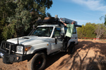
As arranged we were collected from out hotel at 9:00 am by a representative from WaExperts and delivered to their depot where we had a couple of hours training on the systems of the vehicle and then we were on our own.
...click/tap to read the full postOld lace (Coolgardie Western Australia, Australia)
Journal entry for Thursday 7th Mar, 2019 (day 9, kms 339)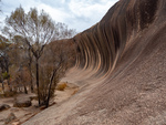
We started the day with the obligatory walk around and over Wave Rock, which was after all the point of coming to this place. I can see why some people described it to us as "under whelming" as it is not very high nor very long. But is interesting to discover how such a rock formation comes about. Its a result of differential erosion - different levels of soil moisture erodes the buried granite at different rates and soil moisture is at its highest somehwat below the surface (as surface moisture is evaporated by the sun). You will be pleased to know that there ends the days science lesson.
...click/tap to read the full postCoolgardie (Kalgoorlie, Western Australia, Australia)
Journal entry for Friday 8th Mar, 2019 (day 10, kms 63)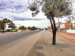
We did some historical research on the town of Coolgardie this morning. It was not difficult to do because the town has conveniently placed plaques at strategic locations that give visitors like us a glimpse into the hey-day of this now sleepy town. Coolgardie was the site of the original gold discovery that eventually gave rise to the mining operation at Kalgoorlie (25 miles away) which today is the largest open cut gold mine in the world. But initially the gold rush was sited in Coolgardie. At its peak the town sported two stock exchanges, 25 stock brokers, 26 hotels, 3 breweries, 7 news papers and 14 churches. Today Coolgardie is a sleepy town of 1200.
...click/tap to read the full postBeach driving (Esperance, Western Australia, Australia)
Journal entry for Sunday 10th Mar, 2019 (day 12, kms 334)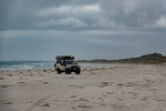
At the Tourist Information Center in Esperance this morning we discovered that Cape Arid National Park is closed indefinitely, and that all the camping grounds at Cape Le Grand are full and are booked out into the future. This disrupted our plans a bit as we had expected to spend the next couple of days exploring Cape Arid and to camp at Cape Le Grand. So after some replanning we spent the day touring the sights of the area, which are mostly beaches (hence the photos) and doing a little beach driving. This latter activity I saw as a good opportunity to get a sense of how our troopie will behave on the soft sand that we expect to find on some of the inland roads we plan to drive.
...click/tap to read the full postThe Eyre Bird Observatory (Eyre Highway, Western Australia)
Journal entry for Thursday 14th Mar, 2019 (day 16, kms 232)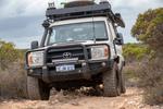
Our day started with a retracing of the Baxter Cliffs route back to Caiguna Roadhouse; no navigation issues this time. A bit less than an hour East of Caiguna we found Cocklebiddy Road house and got some details of the route to the Eyre Bird Observatory (see below for a few details).
...click/tap to read the full postYour next golfing holiday (Eucla, Western Austrtlia)
Journal entry for Friday 15th Mar, 2019 (day 17, kms 255)
Try the Nullarbor Golf Links for your next golfing holiday. The course stretches the 1365 kms of the Eyre Highway between Kalgoorlie Western Australia and Ceduna South Australia. Each hole is located at one of the towns or road houses along the way. We decided to provide a few photos of the course so that our friends who are keen golfers can accurately assess the course conditions before buying plane tickets to Kalgoorlie.
...click/tap to read the full postThe Nullarbor (West of Yalata, South Australia)
Journal entry for Saturday 16th Mar, 2019 (day 18, kms 313)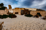
Before hitting the road today we drove a rough track from Eucla Roadhouse to the nearby coast to get a look at the remains of one of the early Eucla telegraph stations which is now partly devoured by the shifting dunes. Thereafter as we traveled east we visited a number of lookouts perched on the edge of the Bunda Cliffs (the sea cliffs that mark the eastern end of the Greast Australian Bight). At one of these lookouts we happened upon the same group of cyclists we passed yesterday and spent sometime chatting with them while they fueled up on some (high energy ?) food.
...click/tap to read the full postA Day of Bays (Venus Bay, South Australia)
Journal entry for Monday 18th Mar, 2019 (day 20, kms 283)
Smokey Bay, Streaky Bay (Hotel), a few rugged coastal cliffs, Venus Bay and throw in the sea lions of Point Labatt and in brief that captures today. What's missing from that brief narrative is just how beautiful todays stretch of coast is and how sparcely populated. The country side is mostly grain or sheep farming country with farm land abutting the coast, with scattered small communities every 60 miles or so. Smokey Bay was one of the smaller communities we passed through today (photo 4), it consists of maybe 2 dozen buildings only.
...click/tap to read the full postOut fishing early (Port Lincoln, South Australia)
Journal entry for Tuesday 19th Mar, 2019 (day 21, kms 360)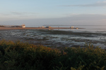
The Eyre Peninsula is at the western end of South Australias time zone so sunrise is around 8:00am at this time of year. However for the guests at the Venus Bay Caravan Park darkness did not prevent an early start on the important business of the days fishing. So by the time there was enough light for a photograph many of those tinnies had alrerady been launched at the local natural sand boat ramp and we only got photos of the late comers.
...click/tap to read the full postAnimal Farm (Cleve, South Australia)
Journal entry for Thursday 21st Mar, 2019 (day 23, kms 116)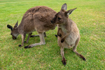
Regular readers of this blog will probably have already deduced that Nina and I like photographing animals/birds, so this morning we could not resist the opportunity to visit Glen Forest Animal Park a short drive from Port Lincoln. It is a bit corny going to such a place but on the other hand if did give us a chance to capture a number of iconic Australian animals.
...click/tap to read the full postIron Knob (Whyalla, South Australia)
Journal entry for Friday 22nd Mar, 2019 (day 24, kms 245)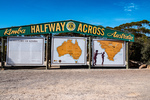
The goal for today was to make it to Whyalla, a largish town almost at the head of Spensers Gulf. Along the way we visited the town of Kimba whose claim to fame, is that it is half way across Australia (from east to west), and that it is the home of the Big Galah. On a nearby hill we also found metal statues of John Eyre (the first European to cross the continent of Australia from Sydney to "Perth") and his aboriginal companion Wylie.
...click/tap to read the full postFuel Filter (Lawrie Park, South Australia)
Journal entry for Saturday 23rd Mar, 2019 (day 25, kms 168)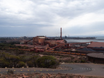
We did a driving tour of Whyalla this morning before hitting the road. From the Lookout on Hummock Hill the scope of the various industrial areas was apparent. This must have been quite an operation in its day.
...click/tap to read the full postNostalgia (Wallaroo, South Australia)
Journal entry for Sunday 24th Mar, 2019 (day 26, kms 149)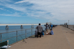
Today was to be a nostalgic day for me as our destination was the small beach town of Wallaroo. This was my mothers home town and the place I spent my first 10-11 years. Wallaroo's original reason for existence was as a copper mining and copper smelting town and in my childhood the old smelter works and the piles of cinders from the defunct smelting operation were great play grounds. After the copper era ended the Adelaide and Wallaroo Fertilizer Company produced agricultural fertilizer from imported fertilizer rock. The piles of ferilizer and rock were also a playground for us kids.
...click/tap to read the full postYorke Peninsula (Minlaton, South Australia)
Journal entry for Monday 25th Mar, 2019 (day 27, kms 187)
Today started with a visit to Wallaroo Museum and a walk around the town to see if my memory could match the geography and I could find my old elementary school. The museum visit was particularly satisfying because I found a series of photos that allowed me to match up my memories of the beach front area with that areas current arrangement. And I found an old building that is still part of an active elementary school that I recognized as my old class room. So I counted the morning a success.
...click/tap to read the full postStump Jump (Wallaroo, South Australia)
Journal entry for Tuesday 26th Mar, 2019 (day 28, kms 145)
We continued our shortened exploration of the Yorke Peninsula today with a visit to a few of the small seaside towns on the eastern shore of the peninsula and saw more great beaches, jetties and well maintained small towns. If one wanted a beachfront lifestyle, largely devoid of other people the Yorke (and Eyre) peninsulas would be good places to consider. At the town of Ardrossan we came across a Museum that featured the Stump Jump Plough, ... a what you might ask (see below).
...click/tap to read the full postAnother Toyota Dealer (Port Wakefield, South Australia)
Journal entry for Wednesday 27th Mar, 2019 (day 27, kms 81)
We spent the morning walking part of Wallaroo's Tourist Drive and capturing a few more photos of my "home town"; I now surely have enough to satisfy my nostalgia.
...click/tap to read the full postVictor Harbor (Victor Harbor, South Australia)
Journal entry for Thursday 28th Mar, 2019 (day 28, kms 195)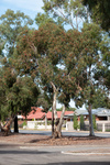
Victor Harbor is South along the coast from Adelaide, it is the major town in a large wetland area that constitutes the mouth of the Murray River (Australia's longest river), and that's where we ended today, a base for a couple of days exploring the area.
...click/tap to read the full postWet and windy (Cape Jervis, South Australia)
Journal entry for Friday 29th Mar, 2019 (day 29, kms 77)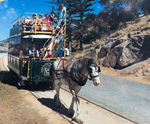
We put a bit of effort into doing some sightseeing around Victor Harbor today but really the weather was against us. So around midday we headed for Cape Jervis (about 50 km away) where we decided to spend the night so that we would be close to the ferry to Kangaroo Island which we have to catch tomorrow morning at 8:30.
...click/tap to read the full postKI and interesting facts (Cape Jervis, South Australia)
Journal entry for Saturday 30th Mar, 2019 (day 30, kms 0)
As I mentioned in yesterdays post, this morning we were off to Kangaroo Island on the 8:30 ferry. What I did not mention was that we had booked to pick up a day long bus tour once off the ferry. The hope was that the bus tour would give us an overview of Kangaroo Island since we did not have the time in our schedule to spend days touring by ourselves.
...click/tap to read the full postThe Coorong (Goolwa, South Australia)
Journal entry for Sunday 31st Mar, 2019 (day 31, kms 86)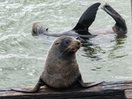
The reason we came to this part of the country was to see an area called the The Coorong. For us (particularly Nina) the Coorong has a couple of attractions or at least points of interest. Firstly it is the setting for a famous Australian story and film called Storm Boy and secondly it is the point at which Australia's biggest river system (The Murray Darling) empties into the ocean. The Coorong is an extensive tidal estuarial region that encompasses the mouth of the Murray River.
...click/tap to read the full postBusiness and Catchup (Adelaide, South Australia)
Journal entry for Wednesday 3rd Apr, 2019 (day 36, kms 47)
We spent the nights of April 1st, 2nd, 3rd in Adelaide primariliy for the purpose of "business" (more vehicle work and completing US tax returns) rather than sight seeing. Never the less we took the opportunity to renew our aquaintence with Adelaide city/downtown and the area around the Torrens River. The Adelaide metro area has grown dramatically since our last visit over 20 years ago and is quite a sprawl. The city and Torrens area have undergone some major upgrades but has retained the charm of the city we knew.
...click/tap to read the full postBurra Burra (Hallett, South Australia)
Journal entry for Thursday 4th Apr, 2019 (day 37, kms 209)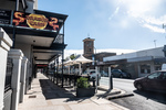
We spent the morning navigating our way through the northern sprawl of the Adelaide metro area, passing through the township of Elizabeth, which was once a major car manufacturing center for GM when it was still building the Australian car the Holden.
...click/tap to read the full postGorges of the Flinders (Flinders Rangers, South Australia)
Journal entry for Saturday 6th Apr, 2019 (day 39, kms 177)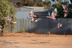
The cockatoos were out and about while we were fueling up in Hawker this morning and Nina managed to capture a flock of them in flight. There after, as you can see from the rest of the photos, we spent the day sightseeing by following a series of rough unpaved scenic roads or tracks through gorges or steep sided creek valleys. Morolana Road, Brachina Gorge and Bunyeroo Gorge. We found these gorges quite fascinating. In this incedibly dry country where most of the vegetation is low scrub, the creeks are an avenue of very large River Gum trees.These trees survive in this place by driving their roots down hundreds of feet to find the creeks water that is often still flowing underground.
...click/tap to read the full postChambers Gorge (Chambers Gorge, South Australia)
Journal entry for Sunday 7th Apr, 2019 (day 40, kms 192)
Today was intended to be a bit of nostalgia, we planned on camping the night in a place named Chambers Gorge, it is an informal camping area on private property that is somewhat off the beaten track and being "informal" has no facilities at all. The nostalgia relates to the fact that we camped in this place in 1997 when on an outback trip with our then young children and we remember this place with some fondness.
...click/tap to read the full postFlies (Arkaroola, South Australia)
Journal entry for Monday 8th Apr, 2019 (day 41, kms 112)
As you can see the flies were back this morning as soon as the sun appeared; this prompted us to get moving and keep moving. The second photograph are the signs at the junction of two gravel roads; the view was the same in every direction. It is amazing even to us how empty this place can sometimes feel; in todays driving we passed 3 other vehicles and one of those was a road grader.
...click/tap to read the full postSome 4LOW (Leigh Creek, South Australia)
Journal entry for Tuesday 9th Apr, 2019 (day 42, kms 191)
This morning we retraced yesterday afternoons route to the Bolla Bollana Smelter ruins and there after a series of 4wd tracks south through part of the Gammon Ranges National Park. Again this was a nostalga exercise reliving past adventures. It was also the first time on this journey where there was any substantial need for 4wd low range as there were some steep rock climbs and descents. The descent to the abandoned Idninha out station building was probably the most demanding.
...click/tap to read the full postFirst flat and Aussie Icon (Marree, South Australia)
Journal entry for Wednesday 10th Apr, 2019 (day 43, kms 133)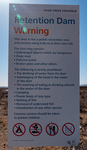
We got going early this morning wanting to be at the Leigh Creek gas station at 8:00 (its opening time) to get the flat tire fixed. However Leigh Creek does not fix tires, I was directed 5 km up the road to Copley where the task was completed promptly. More evidence for me that Copley will eventually win out as the tourist stop on this part of the trek.
...click/tap to read the full postA Technological History (Roxby Downs, South Australia)
Journal entry for Thursday 11th Apr, 2019 (day 45, kms 275)
Yesterday while planning our current little side trip I wondered about the name of the Borefield Road but this mornings drive south towards Roxby Downs answered at least part of my question. The road was lined with capped bores (spear point wells down to the artesian water table) with periodic larger structures including filling stations for water tankers.
...click/tap to read the full postLake Eyre (Haligan Bay, South Australia)
Journal entry for Friday 12th Apr, 2019 (day 46, kms 313)
We spent the morning retracing our route of yesterday along the Bore Field Road and then rejoined the Oodnadatta Track. Along the track we stopped at a few points of interest, either old railway sidings (with ruins of railway buildings, broken bore machinery and in one case an old cast iron water tank) or natural springs. This part of inland Australia sits on top of the Great Artisian Basin, a large underground water deposit that covers 22% of Australias area and is estimated to hold 15,600 cubic miles of water. Along the Oodnadatta Track this water comes to the surface in natural springs in mound formations and provided natural staging places for early settlers and the early railways.
...click/tap to read the full postCadibarrawirracanna (Coober Pedy, South Australia)
Journal entry for Saturday 13th Apr, 2019 (day 47, kms 222)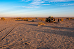
The first stop after leaving Lake Eyre this morning was the village/roadhouse of William Creek which consists of a pub, a scenic flight business in a single building, a bush campground and a gas station attached to the pub. One of our guide books described it as an iconic outback pub, it certainly is an interesting building. Seems to be mostly built from railway sleepers. Perhaps the most interesting thing about William Creek is that it is located on Anna Creek Station the largest cattle station (ranch) in the world. At 9142 sq miles it is just a little bit bigger than the country of Israel. The station was originally established by Sidney Kidman who realized that the only way to run cattle successfully in the Australian outback was to have a very low ratio of cattle to land. ß
...click/tap to read the full postNight on a cattle station (Arckaringa, South Australia)
Journal entry for Sunday 14th Apr, 2019 (day 48, kms 159)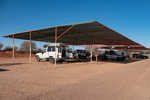
It took us a little while to get ourselves out of Coober Pedy this morning. What with queuing up to buy fresh drinking water, buying a new gas stove, Nina's 10,000 steps and my mandatory cafe visit for a coffee we did not even get to the underground museum and mine until 10:00am. The museum was pretty good and of course depicted the story of opal discovery and the development of mining in this region. Like a lot of pioneer stories the beginning of opal mining at the Coober Pedy location is a tale of determination bordering on crazyness. After the initial discovery two men arrived at the site with 100 gallons of water on a bullock dray and stayed mining until their water ran out. To extend their water they collected all used waste water in a drum and skimmed the "clean" water off the top. When that finally ran out they had to walk 90 miles to a nearby rail head. All this in a region that is recognized as the driest part of Australia, the driest continent on earth.
...click/tap to read the full postAlgebuckina Bridge (Oodnadatta, South Australia)
Journal entry for Monday 15th Apr, 2019 (day 49, kms 211)
We discovered this morning that the family that manages Arckaringa are on vacation and the young man that arrived last night works for the company that owns the station (the same company owns an adjacent property). Our route this morning, as planned yesterday, took us through what is called the Painted Desert, an area of small mesas with multi-colored soil and rock layers from the variation of mineral content.
...click/tap to read the full postDalhousie Springs (3O'Clock Creek, South Australia)
Journal entry for Tuesday 16th Apr, 2019 (day 50, kms 190)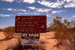
I have used the word "iconic" a number of times in recent posts and I am now regreting that as I want to use it again, to describe our destination for today. The place is called Dalhousie Springs and it is well known in Australia for a number of different reasons, perhaps the most common being the complex of hot thermal pools that make it a little oasis in the desert but also because it is the western entrance to the 4wd track across the Simpson Desert to Birdsville, one of the most famous outback 4wd trails. As you can see from the photo of the sign that track was now (or recently) closed due to of all things flood waters coming down from northern Australia.
...click/tap to read the full postFinke and the Ghan Heritage Trail (Chambers Pillars, Northern Territory)
Journal entry for Wednesday 17th Apr, 2019 (day 51, kms 339)
Today is my (Robert's) 70th birthday, but there were no birthday celebrations this morning, but instead an early start in order to have an excuse to be in the fly proof air conditioned interior of our vehicle. About 75km from last nights camp over more rough sandy/rocky tracks we came to Mt Dare Homestead which is now a hotel and restaurant/cafe as well as a station homestead. We cooled our heals at Mt Dare for a few hours having coffee, lunch and talking to the couple from Zimbabwe who were managing the place for a few weeks.
...click/tap to read the full postThe Alice (Alice Springs, Northern Territory)
Journal entry for Thursday 18th Apr, 2019 (day 52, kms 199)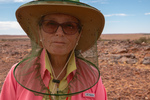
It took us until just after lunch today to retrace the Chambers Pillar track, complete the Ghan Hertiage Trail, and arrive in Alice Springs - often called The Alice by Australians. The Chambers Pillar Track had a spectacular example of a bull dust hole. This is an area on a road or track where the soil has turned to dust about the consistency of talcum powder and the powder or dust fills one or more large holes in the roadway making the hole very difficult to see. The last three photos are of our vehicle driving through that bull dust hole.
...click/tap to read the full postGorges, Gaps and Chasms (Serpentine Chalet, Northern Territory)
Journal entry for Wednesday 24th Apr, 2019 (day 58, kms 217)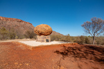
Today we commenced the very popular tourist route of the Western MacDonnell Ranges, a route that will eventually take us to the rock, "Uluru". The MacDonnell Range is really a small remnant of a much larger mountain range that has been weathered away to its current modest size. Many of the tourist attractions on this route are gorges, cut by creeks, through the MacDonnells or adjacent ranges, and often such a gorge has an almost permanent water hole at its heart. The water remains in the narrow chasms because of the lack of direct sunlight and the much cooler environment. In a number of cases, such as Serpentine Gorge, the water is also fed by a natural spring with water either from the mountain's own rock which acts as a sponge or the Great Artesian Basin.
...click/tap to read the full postDingo sighting (Glen Helen, Northern Territory)
Journal entry for Thursday 25th Apr, 2019 (day 59, kms 47)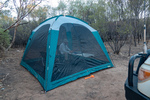
We start todays post with a couple of photos of last nights camp. Thereafter a few photos of an aboriginal ochre mine or pit. Aboriginal people collect minerals of various colors from this river bank (and other ochre pits like this one) and use them for body paint and making art. In other parts of Central Australia such colored minerals were traded between tribes and regular trade routes existed.
...click/tap to read the full postLutherans and Palm Trees (Palm Valley, Northern Territory)
Journal entry for Friday 26th Apr, 2019 (day 60, kms 153)
Today was packed full of interesting sights, but the one that stands out was Palm Valley; but that comes a little later in this post. First off was another gorge, this one called Red Bluff Gorge and as you by now can guess there was a wide dry sandy riverbed with lots of Ghost and River Gums that led to a narrow cleft in a wall of red sandstone and in that cleft there was a waterhole. This particular waterhole had its own supply of floatation toys to entertain the children of those families that neglected to bring their own "floaties".
...click/tap to read the full postA hitch hiker (Kings Canyon, Northern Territory)
Journal entry for Saturday 27th Apr, 2019 (day 61, kms 207)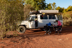
Today started with a photo of last nights camp. Then today was just a travel day, retraced our route over the rough gravel track to Hermannsburg, a quick picture of the house of Albert Namatjira (famous Australian Aboriginal artist) then 200+km of more rough road to Kings Canyon Resort.
...click/tap to read the full postKings Canyon Walk (Kings Creek, Northern Territory)
Journal entry for Sunday 28th Apr, 2019 (day 62, kms 67)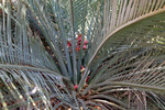
The Kings Canyon Rim Walk starts about 10 km east of the Resort so we had to pack up for the day in order to drive to the start of the walk. The start of the walk could be a bit intimidating, with all kinds of safety warnings. For example if the days max temperature is going to be over 36°C (approx 100°F) then it is manditory to start the walk before 9:30 am (there is a gate to enforce this). Along the walk there are periodic emergency beacon stations where walkers can signal for help (like one of those personal safety satellite devices), there are periodic helicopter landing zones and large outdoor medical chests. One can only conclude that lots of people have been injured and/or rescued on this walk; or maybe the parks management are a little overly cautious.
...click/tap to read the full postTourist central (Yalara, Northern Territory)
Journal entry for Monday 29th Apr, 2019 (day 63, kms 260)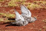
Todays post starts with some images from King Creek last night and this morning. The first image is of an ancient plant called a cycad, this one is female. The birds fluffing up their wings are Spinifex Pigeons, they started this behavior when one of the King Creek workmen turned on a water sprinkler. A number of these birds landed in the area being watered and essentially started taking a shower in the spray. There is an interesting story associated with the donkey pictured in image 6. When the camel in image 5 was young it was abandoned by its mother and the donkey took over nursing the then small baby camel. Now the two are inseparable. The images of the tents are examples of the range of accomodation that was available at King Creek.
...click/tap to read the full postMixed fortunes (Curtin Springs, Northern Territory)
Journal entry for Tuesday 30th Apr, 2019 (day 64, kms 149)
As planned the three of us arrived at the Sunrise Viewing Area at 6:50 (20 minutes to spare). The place was crawling with people, at least a couple of thousand, cameras, smart phones, and selfies everywhere. To everyones disappointment there was cloud in the east at sunrise so while the sun on the cloud was spectacular the morning rays did not illuminate and color the face of Uluru.
...click/tap to read the full postUluru and Olgas in the sun (Curtin Springs, Northern Territory)
Journal entry for Wednesday 1st May, 2019 (day 65, kms 307)
Today was sunny and warm so we were keen to get back to Uluru and capture some of the more typical photos of the big rock in sunshine. No walking around it this time just drive around it and look for some good images, because today we wanted to do a hike at another nearby bunch of rocks called either The Olgas or Kata Tjuta.
...click/tap to read the full postGaps (Conners Well, Northern Territory)
Journal entry for Sunday 5th May, 2019 (day 69, kms 245)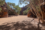
Today we started the long trek to Darwin, but first we had to take a short trip into the East MacDonnell Ranges and look at a few of the closer attractions. As I have mentioned previously the MacDonnell Ranges are the remnant of an acient much larger mountian range that has been weathered down to what is the MacDonnells today. The present day MacDonnels are relatively low (a few hundred feet to maybe 1200ft), consist of a long jagged ridge of exposed strata with gorges and gaps breaking through from south to north where rivers have carved their way through. So today we were off to see a few of these "gaps" which typically are dry sandy stream beds with jagged side walls and picturesque stands of ghost gums. Along the way we happened to find the largest Ghost Gum in Australia (and hence the world).
...click/tap to read the full postUFOs and an EMU (Wycliffe Well, Northern Territory)
Journal entry for Monday 6th May, 2019 (day 70, kms 275)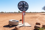
Today was a pretty tedious day. The road was mostly straight, the scenery low scrub, towns non-existent, and flies in swarms anytime we stopped and opened the car door. The only break from the monotony of driving were the occassional Road Houses. These are basically a gas station, restaurant and pub, maybe some basic motel rooms, maybe a caravan park and a few dwellings for locals (population usually well under 100).
...click/tap to read the full postMarbles (Renners Spring, Northern Territory)
Journal entry for Tuesday 7th May, 2019 (day 71, kms 287)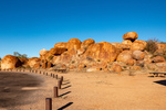
A little north of Wycliffe Wells is a collection of granite boulders known as The Devils Marbles. We made a point of getting an early start so we would get to the marbles while the morning light was still shining on the boulders. It's quite an impressive collection of boulders in various states of erosion, including a few that have been split down the middle like they were cut with a knife.
...click/tap to read the full postWhat a crowd (Daly Waters, Northern Territory)
Journal entry for Wednesday 8th May, 2019 (day 72, kms 239)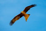
We got a visit from some birds of prey this morning while packing up. They looked particularly spectacular against the bright blue sky so we spent a while trying to "get some pics". The remainder of the day was not note worthy until we reached Daly Waters, our next camping spot.
...click/tap to read the full postThe Tropics (Mataranka, Northern Territory)
Journal entry for Thursday 9th May, 2019 (day 73, kms 224)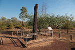
I neglected to mention in yesterdays post that Daly Waters was also an important base during World War II. The old airfield and related buildings can still be seen. Indeed some sources claim that Daly Waters was the first international airport in Australia as planes from Asia set down here on their way into Australia.
...click/tap to read the full postMore Never Never (Pine Creek, Northern Territory)
Journal entry for Friday 10th May, 2019 (day 74, kms 256)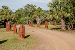
Back in 1984 when the movie was made from the novel "We of the Never Never", a replica of the Elsey homestead building was constructed as a set for many of the scenes in the movie. This morning we visited that replica.
...click/tap to read the full postA Sojourn in Darwin (Darwin, Northern Territory)
Journal entry for Wednesday 15th May, 2019 (day 79, kms 186)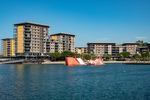
Arrived in Darwin on Saturday 11th May, a day earlier than we had originally planned. Our early arrival was deliberate as we wanted to be in Darwin, and settled in, by Sunday in order that we could go to the Mindil Beach Market which operates Sundays and Thursdays from about 4:00pm until 9:00pm.
...click/tap to read the full postLitchfield (Florence Falls Litchfield NP, Northern Territory)
Journal entry for Thursday 16th May, 2019 (day 80, kms 133)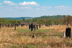
Today we are at Litchfield National Park, about 130 km SSW from Darwin. One of the early "photo ops" in Litchfield is a (or some) very large Cathedral Termite Mound, and they are impressive but mounds of a more modest size are everywhere in this country so they are only of passing interest. What Litchfield is really about is water and the ability to swim in it. During the wet season the entire country side floods to a depth of meters and areas like Litchfield (large raised plateaus of rock) act like a sponge and absorb vast quantities of the wet season water. Once the dry season starts the sponge starts to disgorge that water and many rivers are created. Litchfield is one such outcroppings and the outflowing water has created a number of nice waterfalls with large pools at the bottom of the base. These pools, the falls, and the rivers/streams that feed the falls make great swimming holes. Of course only after the rangers have checked them to ensure there are no crocodiles hanging about.
...click/tap to read the full postMore swimming holes (Wangi Falls Litchfield NP, Northern Territory)
Journal entry for Friday 17th May, 2019 (day 81, kms 40)
We had planned to spend three nights in Litchfield and tonight was surposed to be spent at Surprise Creek Falls along the Litchfield-Daly Road, but that plan got changed as the Litchfield-Daly Road has not re-opened after the wet season. So we simply jumped to the day 3 plan and headed for Wangi Falls. This is probably the main draw card within Litchfield. It has a kiosk, an office of one of the helicopter tour companies, wifi, and a most spectacular pool and water falls. We spent a nice lazy day there taking advantage of the cooling effect of the water.
...click/tap to read the full postA sunset cruise (Corroboree Road House, Northern Territory)
Journal entry for Saturday 18th May, 2019 (day 82, kms 216)
So we are a day ahead of schedule thus the sunset cruise on Corroboree Bilabong we have booked for tomorrow night would, ideally, be more convenient if it could be tonight. So as we leave Litchfield and start the trek towards Kakadu that is our plan, to see if we can rescehdule. Thus we head for Corroboree Roadhouse on the Arnhem Highway (the road to Kakadu) where we are supposed to meet the shuttle to the cruise tomorrow night in the hope we can reschedule.
...click/tap to read the full postKakadu (Jabiru, Northern Territory)
Journal entry for Sunday 19th May, 2019 (day 83, kms 256)
Today was our first experience of Kakadu National Park, the largest national Park in Australia at 20,000 square km (about 1/2 the size of Switzerland). Over half the land that comprises the park is actually owned by Aboriginals and the entire park is jointly managed by the Parks Australia . A quick look at a map of the park will reveal two main access roads, The Arnhem Highway and the Kakadu Highway that meet at the town of Jabiru. Interestingly Jabiru's primary purpose is as a "company town" for the nearby Ranger Uranium Mine. Although tourism is also a major activity within the town.
...click/tap to read the full postGunlom Falls (Gunlom Falls Kakadu, Northern Territory)
Journal entry for Monday 20th May, 2019 (day 84, kms 202)
This morning we noticed that we were not the only refugees from last nights rain storm. There were a number of 4x4 vehicles in the parking lot that looked set up for camping, and there was a lot of wet gear hanging on the clothes line or laying on the concrete building porch.
...click/tap to read the full postDarwin Again (Darwin, Northern Territory)
Journal entry for Thursday 23rd May, 2019 (day 87, kms 0)So we came back to Darwin after Gunlom because I noticed that the solar panel on top of the tent was not doing anything and we anticipate that over the next 6 weeks we will have many camps without electricty to recharge the battery that runs the refrigerator. So the folks at WAExperts.com.au had organized for a sparky (auto electrician) to drop by our campground and fix the problem. Turned out to be a corroded connection which was fixed by replacing a bunch of wires and some connectors. We also took the opportunity to update what we think of as the banner photos, the photos at the top of the home page. click this link and watch the slide show.
...click/tap to read the full postMoving again (Pine Creek, Northern Territory)
Journal entry for Friday 24th May, 2019 (day 88, kms 235)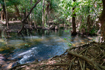
The solar panel is fixed, we are stocked up on supplies and are on the road again. So south to Pine Creek (again) to spend another night at the Lazy Lizard campground.
...click/tap to read the full postHouston We have A .... (Katherine, Northern Territory)
Journal entry for Saturday 25th May, 2019 (day 89, kms 164)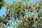
Last evening we noticed that the trees at the entrance to the Lazy Lizard had a good size population of fruit bats. They were quite noisy, sqwarking away for much of the night. This morning with some better light Nina caught a few photos of these surprisingly large creatures, as well as a few scenes from the town of Pine Creek, the railway museum and a local cricket match.
...click/tap to read the full postBoab Trees (Limestone Gorge Gregory NP, Northern Territory)
Journal entry for Tuesday 28th May, 2019 (day 92, kms 295)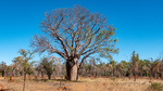
The vehicle problem put a bit of a dent in our schedule as we have a booking for a lake cruise on Thursday as well as reservations for a camping site for Wednesday and Thursday at Lake Argyle and we had planned to spend 3-4 days covering the distance to Lake Argyle. Now we have only 2 days thus this morning we were up before sunrise getting ready for an early start.
...click/tap to read the full postLake Argyle - A birds eye view (Lake Argyle, Western Australia)
Journal entry for Wednesday 29th May, 2019 (day 93, kms 283)
We took an early morning hike before leaving Limestone Gorge and captured a few more pictures of Boab trees (which we learned from a nearby plaque probably arrived in Australia from Madagascar on ocean currents). Then retraced our route over the rough entry track.
...click/tap to read the full postReturn to NT (Keep River NP, Northern Territory)
Journal entry for Saturday 1st Jun, 2019 (day 96, kms 82)
Today we ducked back into the Northern Territory a few kilometers to visit, and camp at, Keep River National Park. On paper the attractions of this park are a couple of nice campgrounds and a couple of interesting walks amongst some sandstone cliffs. The first of the days hikes introduced us to the small stone and twig structure in the first picture, which was explained by the info-plaques in pictures 2 and 3.
...click/tap to read the full postAn early morning hike (Kununurra, Western Australia)
Journal entry for Sunday 2nd Jun, 2019 (day 97, kms 78)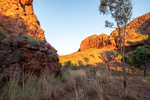
We were up well before sunrise this morning as we had decided to undertake the Jarnem Loop hike and all the advice we had read suggested getting to the lookout for the sunrise. Well we did not quite manage a sunrise at the lookout but we did get some photos of the rising suns rays on the sandstone cliffs. Towards the end of the loop we came to Nigli Gap; a series of cliffs which show signs of aboriginal habitation.
...click/tap to read the full postEl Questro (El Questro, Western Australia)
Journal entry for Monday 3rd Jun, 2019 (day 98, kms 112)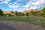
Before getting underway this morning we took a few photos around our campground, and around the town of Kununurra. In particular we wanted to demonstrate the relative lushness of the area as the Ord River Valley around Kununurra is the region that is irrigated by the water released from Lake Argyle.
...click/tap to read the full postStarting the Gibb (Ellenbrae Station, Western Australia)
Journal entry for Wednesday 5th Jun, 2019 (day 100, kms 174)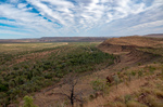
We started the day with a little bit of a 4x4 adventure on an El Questro track called Saddle Back Ridge. A long steep climb with lots of "steps" and a few off camber hairpins before arriving at a lookout that gave a good 360 degree view of the property. That seemed like a good note on which to take our leave from El Questro and start the "famous" Gibb River road.
...click/tap to read the full postCorrect handling of a cane toad (Drysdale Station, Western Australia)
Journal entry for Thursday 6th Jun, 2019 (day 101, kms 132)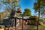
Before leaving Ellenbrae this morning we drove back to the homestead to try their coffee and scones. This seems to be a feature they are trying to cultivate as a "differentiator" for their tourist business. While sitting in the quirky but attractive cafe devouring said coffee and scones we started reading an information sheet that is provided at each table. From it we learned some interesting facts.
...click/tap to read the full postKimberley Plateau (Mitchell Falls, Western Australia)
Journal entry for Friday 7th Jun, 2019 (day 102, kms 186)
It's a bit hard to put into words the contradictions that today brings. On the one hand we are in an incredibly remote place and on the other hand tonights campground will have quite a population (maybe 100 people), we will see a number of offroad tourist buses at the campground, and there will be a helicopter base at the campground. Our starting point for today is already 500km (310miles) from the last town we passed through (Kununurra), it is the only fuel stop we have seen since that town, and today we are going to drive another 185 km (110miles) north and west from Drysdale.
...click/tap to read the full postReturn to the Gibb (Manning Gorge, Western Australia)
Journal entry for Monday 10th Jun, 2019 (day 105, kms 171)
With our Mitchell excursion done today we returned to the Gibb River Road and continued our westward journey. The first leg of the days journey was 60km south from Drysdale to the Gibb River Rest area and then 110 west to Mount Barnett Road House and the nearby Manning Gorge Campground. There was not much of note on todays drive, lots of road corrugations, a surprising number of fellow travellers, maybe 50 other cars most towing a camper of some form and two notable river crossings where we took a few photos. We crossed the Gibb River just before rejoining the Gibb River Road and the Barnett River just before the similarly named road house.
...click/tap to read the full postFreshies (Windjana NP, Western Australia)
Journal entry for Tuesday 11th Jun, 2019 (day 106, kms 205)
We made a start before sunrise this morning and walked from the campground to Manning Gorge. The start of the walk is quite interesting as one has to cross a large waterhole, and a small aluminium boat with rope tow is provided for the purpose. By the time we returned from the walk the kids staying in the campground were up and playing in the waterhole and a couple of them offered to be our ferrymen. The walk to the Gorge was hot and a bit tedious but the gorge provided some nice photos of cliffs reflected in the clear water.
...click/tap to read the full postCompleting the Gibb (Broome, Western Australia)
Journal entry for Thursday 13th Jun, 2019 (day 108, kms 367)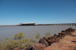
Today turned into a long day, at least by our standards. We got an early start from Windjana, eventually the paved road arrived and we made good time into the coastal town of Derby on King Sound at the mouth of the Fitzroy River. We found the place a little crowded (with tourists), and the single campground seemed packed so we decided to push on to Broome.
...click/tap to read the full postCape Leveque (Gumbanan, Western Australia)
Journal entry for Sunday 16th Jun, 2019 (day 111, kms 279)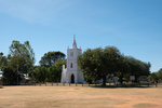
We have a few things planned in Broome next week but the thought of hanging around in one place for over a week was more than Nina could tolerate so we decided to take a little excursion to Cape Leveque about 200km north of Broome. The peninsula that is tipped by Cape Leveque is all aboriginal land and hence is very lightly inhabited but non the less is a very popular tourist destination.
...click/tap to read the full postReturn to Broome (Broome, Western Australia)
Journal entry for Monday 17th Jun, 2019 (day 112, kms 228)
Before returning to Broome this morning we wanted to visit Kooljaman, an aboriginal owned tourist resort that provides accommodation ranging from luxury cabins through to unpowered campsites. They were fully booked so we could not camp there last night. Also this property is the only place where one can access the beach front at Cape Leveque. Photo 2 is the access road to Kooljaman. We spent a couple of hours at Kooljaman exploring their beaches and facilities before starting the return trip to Broome.
...click/tap to read the full postStairway to the Moon (Broome, Western Australia)
Journal entry for Tuesday 18th Jun, 2019 (day 113, kms 0)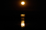
One of the big events in Broome is called Stairway to the Moon. This takes place whenever a low tide and new moon coincide. Since the downtown beach area of Broome face East one can watch the new full moon rise over the sea, and when the tide is low the moon light reflects off the sand/mud to give the impression of stairs leading to the rising moon. This is now a big event and attracts thousands of spectators. So this evening about 6:17pm we were at the Town Beach to buy dinner from one of the many food stalls and watch the moon rise. Photos were difficult.
...click/tap to read the full postRAAF Boab Quarry (RAAF Boab Quarry, Western Australia)
Journal entry for Thursday 20th Jun, 2019 (day 115, kms 363)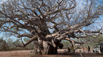
Today we leave the coast heading towards Fitzroy Crossing and then Halls Creek eventually. Todays route retraces part of the route we followed from Derby to Broome and then branches onto the Great Northern Highway. When researching this leg of our journey we noted that camping places were few and so todays leg is a longer one than usual and ended at the unusually named RAAF Boab Quarry. For non Australian readers RAAF is an acronym for the Royal Australian Air Force. There were few scenic attractions on todays route, the Boab Rest Area (photo 1) being an exception, otherwise the day was an easy drive on good paved roads with light traffic.
...click/tap to read the full postGeike Gorge (Fitzroy Crossing, Western Australia)
Journal entry for Friday 21st Jun, 2019 (day 116, kms 98)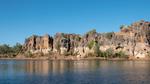
In contrast to yesterday today was a very short drive, less than 100 km, into Fitzroy Crossing and then north about 20km to a small National Park containing Geike Gorge. The gorge is formed by the Fitzroy River cutting through the Napier Range. You might recall we visited another part of the Napier Range at Windjana where we saw lots of "freshies" and observed fruit bats trying to avoid those same crocs while taking a drink. At Geike we took a boat tour of the Gorge. The photos tell that story well.
...click/tap to read the full postTo Halls Creek (Caroline Pool, Western Australia)
Journal entry for Saturday 22nd Jun, 2019 (day 117, kms 312)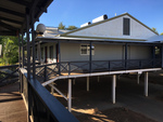
The main accommodation building at Fitzroy Crossing Lodge (photo 1) was quite interesting as the entire structure seems to be corrugated metal, and surrounds the swimming pool.
...click/tap to read the full postBungle Bungle (Bungle Bungle, Western Australia)
Journal entry for Sunday 23rd Jun, 2019 (day 118, kms 224)
The access road to Purnululu National Park and the Bungle Bungle range is about 100km north of Halls Creek and it was an easy drive on paved road to that access road. From there to the Park Visitors Center is another 56km and we had heard all kinds of horror stories about how bad this twisty gravel road was. But to our surprise the road generally was in ok shape and had some very interesting scenery though we did not get any views of the Bungle Bungle Range at this time.
...click/tap to read the full postThe Bungles II (Bungle Bungle, Western Australia)
Journal entry for Monday 24th Jun, 2019 (day 119, kms 0)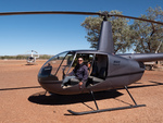
The main activity today was our 30 minute helicopter tour of the Bungle Range, and as with our previous heli tours we both were well satisfied with the experience. The ariel view gives an entirely different perspective. I won't make any other comment about the flight but rather let the photos tell the story.
...click/tap to read the full postThe Bungles III and Halls Creek (Halls Creek, Western Australia)
Journal entry for Tuesday 25th Jun, 2019 (day 120, kms 245)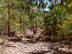
In her inimitable style Nina had another hike on the agenda this morning as a last taste of the Bungles before we made the trek back to Halls Creek. This one was called Echidna. We had no idea why that name was chosen, nor what we would see. The guide to the hike suggested there might be some climbing at the end of the hike but that was all. Unlike our earlier hikes this one was in the North West of the park so we could be certain that there would be no beehive domes.
...click/tap to read the full postTanami I (Wolfe Creek Crater, Western Australia)
Journal entry for Wednesday 26th Jun, 2019 (day 121, kms 150)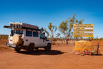
Today we started our traverse of the Tanami Road which will take us back to Alice Springs 1057 km from last nights camp at Halls Creek. Historically the Tanami Track (as it was called) was a cattle droving route along which pastoralists in the Kimberley moved their cattle to market. In the 1960s (after overland droving ceased, and there was no need to detour to find water for the cattle) the track was rerouted and shortened to approximately its current route. Today it is still a remote 80% gravel road that is almost devoid of services. At the North West end it starts 16km from Halls Creek (at a junction with the Great Northern Highway) and to the South Eastern end it joins the Stuart Highway 20km north of Alice.
...click/tap to read the full postTanami II (Tanami Road, Western Australia)
Journal entry for Thursday 27th Jun, 2019 (day 122, kms 294)
We made it to Billiluna this morning during their operating hours and bought 30.77 liters of fuel. Why such a strange amount? Well the rules for buying fuel at Billiluna are, you tell them how many liters you want, they will work out the price of that and round it to the nearest A$10, then give you a fuel card for that amount for which you must lodge a $5 deposit, you take the card out to the pump and dispense the fuel, then return the card and get your $5 deposit back. It turned out that 30.77 liters was almost too much I had to dribble the last 0.77 liters into both tanks to get it all in. But, non the less, we now definitely had enough fuel.
...click/tap to read the full postTanami III (Tanami Road, Western Australia)
Journal entry for Friday 28th Jun, 2019 (day 123, kms 392)
Another day, more kilometers, more red dust and surprisingly few additional creatures. We spotted the dingo at our morning tea break and the snake was crossing the road just a little later. The aeroplane needs some explanation. Roughly mid way along the Tanami Road there is a gold mine called the Granites Gold Mine run by Newmont Gold Mine. While passing this mine we spotted this passenger jet getting ready to takeoff. It was a little mind blowing. Here we are in what feels like the middle of nowhere and we see a jet plane just off to our left!
...click/tap to read the full postTanimi Fini (Alice Springs, Northern territory)
Journal entry for Saturday 29th Jun, 2019 (day 124, kms 256)This morning we knocked off the remaining 260kms into Alice Springs and thus brought our Tanami adventure to a true conclusion. When we fueled up in Alice we had travelled 1084 km since taking on fuel in Halls Creek. In addition to the 30.77L we got in Billiluna we added another 127.5L today in Alice for a total of 158.27L, so we could have made the entire distance without additional fuel. In addition to keeping track of fuel we also kept track of the other vehicles that we passed while we were driving. Over the 3 days prior to today we passed a total of 2 non-articulated trucks, 8 road trains, 34 pickups or SUVs pulling camping trailers or caravans, and 62 non towing pickups, or suvs or actual sedan cars. Since we drove for only 3-5 hours per day and did not count vehicles we saw while camped these numbers are well below the total number using the Tanami Road. The interesting thing is the mix, as well over half the non towing pickups/suvs were travelers like us with camping gear on board. The conclusion is that the vast majority of vehicles using the Tanami Road are doing so for recreational purposes. We find that interesting and entirely consistent with our less formal counts of vehicles we have encountered elsewhere on this trip.
...click/tap to read the full postAlice (Alice Springs, Northern territory)
Journal entry for Tuesday 2nd Jul, 2019 (day 124, kms 31)We stayed in Alice Springs a few days, catching up on some business and having our vehicle serviced in preparation for the next leg of this journey.
...click/tap to read the full postMadding Crowds (11km West of Curtin Springs, Northern territory)
Journal entry for Wednesday 3rd Jul, 2019 (day 128, kms 402)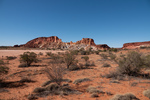
Today we headed back to Uluru where we will start our travers of the Great Central Road, which is the south western leg of Australias (The Worlds?) Longest Shortcut. However, for us, Uluru is a long drive and we plan on ending the day at Curtin Springs and along the way take a detour to Rainbow Valley. Rainbow Valley it turns out is a small but colorful rock outcropping, the track in is typical red sand and the scenery a mix of red sand, light colored spinifex, and desert oak trees. .
...click/tap to read the full postThe start of the GCR (East of Lasseters Cave, Northern territory)
Journal entry for Thursday 4th Jul, 2019 (day 129, kms 301)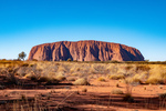
It was cold overnight, we estimated (don't have a thermometer) in the mid 30°F. So consequently we did not hang around at our bush camp but got underway towards Uluru where our observations about the tourist season was further confirmed. Just take a look at the line of people climbing Uluru and what you can't see are the 1000+ vehicles parked just near.
...click/tap to read the full postGood Sumaritan (50km East of Warburton, Western Australia)
Journal entry for Friday 5th Jul, 2019 (day 130, kms 320)
While out for her morning walk Nina found these ants nests (see photo 1) positioned in the middle of a spinifex plant and with their entrance mound covered in spinifex "leaves"; we could not work out whether it was camouflage or some other form of protection.
...click/tap to read the full postRain, but only a little (195km East of Laverton, Western Australia)
Journal entry for Saturday 6th Jul, 2019 (day 131, kms 400)
Last night in camp some dark clouds accumulated and this morning they pretty much covered the sky, and of course we thought rain, possibly. This could be a problem because outback roads are definitely NOT all-weather. With even modest amounts of rain that red sand/dirt turns to mud and the roads either become impassable or get closed by the local police. So we did not want to get caught in that situation. Hence an early start was called for and an extra effort throughout the day to get as close to the end of the dirt as possible.
...click/tap to read the full postLaverton and the end of the dirt (Leonora, Western Australia)
Journal entry for Sunday 7th Jul, 2019 (day 132, kms 314)
Another beautiful sunrise, more camels, lots more dirt road and dust clouds from oncoming vehicles and we are finally in Laverton; the end of the Great Central Road. Laverton turned out to be a very nice looking tidy town, which surprised us a bit as we have seen it described as "uninteresting". There was a nice new information center in the town that had the best maps and info sheets on The Great Central Road we have seen. Pity we could not have got those maps and sheets in Alice Springs or Yulara before we drove the road.
...click/tap to read the full postUnusual art (Lake Ballard, Western Australia)
Journal entry for Monday 8th Jul, 2019 (day 133, kms 160)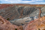
Our first stop today was only a few kilometers south of Leonora at the Sons of Gwalia Gold Mine. Anyone who was associated with share trading in Australia (like me) would have heard this name before, and maybe unlike me knew the origin and meaning of the name. The discovery of the gold deposits and starting of the original mine was undertaken by some Welsh immigrants. Gwalia is the Welsh name for Wales. Today the mine still operates, though now as an underground mine, rather than the original open cut. Next to the present day mine site is a museum and a collection of old equipment and old buildings including the mine managers house (called Hoover House). That house is now a Bed and Breakfast and a cafe. Interestingly Herbert Hoover (eventually 31st president of the USA) took over as Mine Manager in 1898 at the age of 23 and had the managers house built; hence the name.
...click/tap to read the full postA few more figures from Lake Ballard (North of Leinster, Western Australia)
Journal entry for Tuesday 9th Jul, 2019 (day 134, kms 349)
Before departing Lake Ballard this morning we could not resist a few more photos of these strange little statues by the light of the rising sun.
...click/tap to read the full postWiluna (Meekatharra, Western Australia)
Journal entry for Wednesday 10th Jul, 2019 (day 135, kms 289)
About 100km north of last nights camp we came to the town of Wiluna. This is yet another Western Australian town that was once a major gold mining town and in the 1930s had a population of around 9000. Today the population is around 700 and is probably most well know as the southern entrance to the Canning Stock Route and the Western end of the Gunbarrel Highway. It is interesting to us that one of the motivations for the Gunbarrel was to place instruments as part of rocket development at Woomera. While at Woomera earlier in this trip we heard from an Airforce Officer just how valuable the Woomera Rocket Range is because of the length of flight path over un-inhabited territory it offers.
...click/tap to read the full postSponge Bob (Kumarina Road House, Western Australia)
Journal entry for Thursday 11th Jul, 2019 (day 136, kms 252)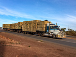
There is not much to say about today. Just another day traveling North on the Great Northern Highway with many road trains, mines and not much else. Just to illustrate the point; the app we are using to find camping places (and other places of interest) noted that near 25 Mile Well was a sight of interest called Sponge Bob mail Box. This is nothing more than the mail box for one of the local pastoral stations decorated up a bit. Other wise we just recorded some of the heavy vehicles we encoutered.
...click/tap to read the full postKarijini here we come (Jnc GNH and Karijini Drive, Western Australia)
Journal entry for Friday 12th Jul, 2019 (day 137, kms 318)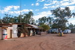
Today was really about getting to and finding a camping spot close to Karijini National Park so that tomorrow we would have an entire day to commit to exploration of the park. This is because we could only get one night in either of the campgrounds at the park. Todays photo record, starts with a few photos of Kumarin roadhouse and a few "along the way" shots as well.
...click/tap to read the full postKarijini I (Dales CG Karijini, Western Australia)
Journal entry for Saturday 13th Jul, 2019 (day 138, kms 184)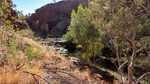
We were at Karijini and starting our first "hike" by 8:30 thereby facilitating what turned out to be a very full day.
...click/tap to read the full postKarijini II (Tom Price, Western Australia)
Journal entry for Sunday 14th Jul, 2019 (day 139, kms 112)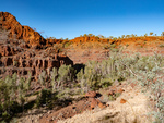
After yesterdays achievements, and in light of the fact that we could not camp at Karijini tonight, todays plan was to "do it all"; or at least our version of that. We would "do" Dales Gorge and hit all the high points. See below.
...click/tap to read the full postNameless (Rest Area Marble Bar Road, Western Australia)
Journal entry for Wednesday 17th Jul, 2019 (day 142, kms 333)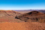
As you can see from the date of this entry we spent three nights in Tom Price dealing with some family business. This morning when we departed our plan was to head west towards Millstream-Chichester National Park. But we quickly discovered that all roads in that direction were unpaved and had a lot of mine traffic, particularly 4 trailer road trains. Now we dont mind dirt roads but in conjunction with road trains they are tedious and dangerous, and we are a bit weary of dirt roads anyway. So we changed plans late morning and returned to Tom Price with the intent of going towards the town of Marble Bar.
...click/tap to read the full postMarble Bar (Port Hedland, Western Australia)
Journal entry for Thursday 18th Jul, 2019 (day 143, kms 352)
The first half of the drive into Marble Bar was on paved road with a good deal of road train traffic servicing local mines. The second half was a good quality gravel road with almost no traffic. Along both sections the scenery was interesting with striking red rock and soil covered in "buttons" of spinifex, some bright green patches presumably from recent rain and a few creek crossings with some water still present.
...click/tap to read the full postPort Hedland, a quick visit (Dampier, Western Australia)
Journal entry for Friday 19th Jul, 2019 (day 144, kms 322)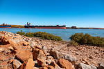
Port Hedland is a major shipping port for iron ore mined in the Pilbara Area of Western Australia as well as being a major service center for such mines and having a major salt mining operation right on the outskirts of the town. With a population of 14,000+ it feels like a small city.
...click/tap to read the full postCrowds (Yannarie Rest Area, Western Australia)
Journal entry for Saturday 20th Jul, 2019 (day 145, kms 411)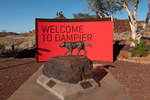
We took a little tour around the Dampier area this morning including stopping at the information display at the town entrance where we read about the Red Dog. It seems a red dog named, among other names, Tally Ho became a well known figure around the Pilbara region as it traveled the region by getting rides with and adopting as temporary owner a bus driver and other travelers. It is said that the dog was made a member of the Dampier Salts Sport and Social Club and the Transport Workers' Union.
...click/tap to read the full postExmouth (Exmouth, Western Australia)
Journal entry for Sunday 21st Jul, 2019 (day 146, kms 172)
The little town of Exmouth sits towards the top east corner of North West Cape, and is surrounded by Cape Range National Park and is the gateway to Ningaloo Marine Park with its coral reefs, colourful fish and migratory whale sharks. Not surprisingly then Exmouth is definitely a tourist town and the population swells from 2200 to over 6000 during the height of the tourist season. In addition North West Cape is the sight of an RAAF base and a Naval Communications base.
...click/tap to read the full postCoral Bay (South of Minilya, Western Australia)
Journal entry for Wednesday 24th Jul, 2019 (day 149, kms 281)
Today was mostly a travel day, we needed to take a big slice out of the distance to Carnarvon. However we did make a couple of scenic stops. The first, Shot Hole Canyon just a few kilometers south of Exmouth and around lunch time we dropped into the village of Coral Bay a very popular spot on the Ningaloo Coast.
...click/tap to read the full postQuobba (Quobba Homestead, Western Australia)
Journal entry for Thursday 25th Jul, 2019 (day 150, kms 239)
A few hundred kilometers of the coastal highway with its red soil and low scrub brought us to the town of Carnarvon. Originally a shipping port for the local wool industry, the town is now perhaps more well known for its role as a major tracking station for NASA's Gemini and Apollo Programs and of course there is an extensive museum of paraphernalia from that era. In addition to visiting the Tracking Station Museum we spent a little time exploring the towns beach front and its now closed but impressive "mile long jetty".
...click/tap to read the full postAnother station (Wooramel Homestead, Western Australia)
Journal entry for Friday 26th Jul, 2019 (day 151, kms 205)
After retracing yesterdays drive from Carnarvon to Quobba our day came to an unexpectedly quick end. For some reason we were both feeling sleepy, and even took the unprecedented step of stopping at a rest area, putting up the tent and having a sleep. This convinced us that rather than continuing with the our original plan of spending the night at Hamelin Pool (a day of about 300km) we should stop early. As luck would have it we were not far from Wooramel River Retreat when this decision was made so that became our nights stopping place.
...click/tap to read the full postRed sand and white beaches (Peron National Park, Western Australia)
Journal entry for Saturday 27th Jul, 2019 (day 152, kms 275)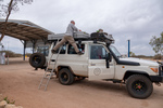
While packing up this morning I noticed that the solar panel was coming adrift from its mounting. The panel had been afixed to some aluminum L sections on the roof with pop-rivets and all the vibration from the rough roads we have travelled have worn the heads off the rivets. As a result one entire side of the panel was no longer fastened to the L section. A few kilometers after leaving Wooramel we stopped at Wooramel Roadhouse and borrowed an electric drill and got some self-tapping screws to re-fasten the panel. That first photo is yours-truly demostrating his balancing skills while installing the new self-tappers.
...click/tap to read the full postA goanna (Monkey Mia, Western Australia)
Journal entry for Sunday 28th Jul, 2019 (day 153, kms 89)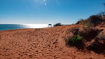
This morning we finished our exploration of Francois Peron NP by driving the remainder of the sandy track to Cape Peron where we spent some time trying to get the "perfect" photo contrasting the red soil against the white beaches and blue ocean. It was a lovely morning and in addition to the great scenery, the great luck of spotting a goanna sunning itself under a bush we enjoyed the bouncing bucking ride along the sandy tracks.
...click/tap to read the full postThe dolphin "Experience" (Nerren Nerren Rest Area, Western Australia)
Journal entry for Monday 29th Jul, 2019 (day 154, kms 243)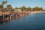
This morning we spent our time attending the Dolpin Feeding Experience, the reason we came to this place. Each morning starting at about 8:15 the rangers invite guests to stand on the beach front and watch a feeding "experience". After about 15 minutes during which one of the rangers does a monologue about the dolphins of the area a small number of members of the audience are invited to feed the dolphins with fish provided by the rangers. Each dolphin is limited to three fish at each experience. So this morning only three guests got to feed a dolpin as there was only one adult dolphin lining up for food. The "experience" is repeated 2 more times if the dolphins show interest.
...click/tap to read the full postThe Murchison River (Muchison House Station, Western Australia)
Journal entry for Tuesday 30th Jul, 2019 (day 155, kms 207)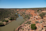
Today was spent in the Kalbarri National Park which has the Murchison River and its associated gorges as its key attraction. Somewhat to our surprise the Murchison had flowing water, we found out from talking to a park worker that this is a result of 6 inches of rain in June. In addition a lot of flowers were blooming including the red flowered flame trees in the photos.
...click/tap to read the full postPink Lake and Hutt River (Hutt River Province, Western Australia)
Journal entry for Wednesday 31st Jul, 2019 (day 156, kms 160)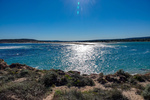
We spent a little time this morning in the town of Kalbarri. This gave Nina a chance to complete her daily walk (and achieve the necessary 10,000 steps) and allowed me to do my morning physio exercises. There after we travelled down the coast south of Kalbarri, which has some nice coastal scenery and is part of the Kalbarri National Park.
...click/tap to read the full postSheep shears (Cliff Head Campsite, Western Australia)
Journal entry for Thursday 1st Aug, 2019 (day 157, kms 230)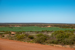
It finally dawned on us this morning that the countryside has changed over the past two days and we are now back in green country where there are wide farm fields of green and flowing water. The deserts and the dry salty coastal plains are no more. Unfortunately this change also signals that our adventure is winding down.
...click/tap to read the full postLimestone blocks (Lancelin, Western Australia)
Journal entry for Friday 2nd Aug, 2019 (day 158, kms 224)
As we left our camping spot this morning we happened to see this Sea Eagle sitting atop a post. The scenic highight of today was a visit to The Pinnacles at Nambung National Park where one can walk and/or drive amongst these strange limestone blocks poking up out of the yellow sand.
...click/tap to read the full postLast driving day (Fremantle, Western Australia)
Journal entry for Saturday 3rd Aug, 2019 (day 159, kms 151)
Today was the last driving day of this adventure. Tonight we camped in a caravan park in Fremantle just south of Perth City. We will be in this caravan park or a nearby hotel until Sunday 11th when the next short non-driving leg of this adventure starts. Our time in Fremantle will be mostly chores such as cleaning our faithful troopy and catching up on family business. But we do plan one sightseeing day while in this area and will report on that when it happens.
...click/tap to read the full postRepurposed Railway Line (Lappa Mt Garnett Trail, Queensland Australia)
Journal entry for Thursday 20th Jul, 2023 (day 3, kms 207)
This morning we continued along the Herberton-Petford road towards the town of Irvinebank with various attractions, an old tin mining town, a very large snake with a black head, a very impressive Brahman bull, and in Irvinebank a very industrious flock of guinea fowl, and an impressive display of old ford cars and trucks in the garage of a local resident.
...click/tap to read the full post