Posts for May, 2019
Uluru and Olgas in the sun (Curtin Springs, Northern Territory)
Journal entry for Wednesday 1st May, 2019 (day 65, kms 307)
Today was sunny and warm so we were keen to get back to Uluru and capture some of the more typical photos of the big rock in sunshine. No walking around it this time just drive around it and look for some good images, because today we wanted to do a hike at another nearby bunch of rocks called either The Olgas or Kata Tjuta.
...click/tap to read the full postA driving day in the Red Center (Alice Springs, Northern territory)
Journal entry for Thursday 2nd May, 2019 (day 66, kms 420)
Today we made the long (for us) trek from Curtin Springs to Alice Springs, all on good quality sealed roads and with surprisingly light traffic. Much of the route was on the Stuart Highway, the main North South road to Darwin, and it provided a good diet of "Red Center" scenery, rolling hills of red sand soil broken by regular creek crossings with their Red River Gums and/or Snow Gums with various mountain ranges in the distance. A good highway to drive for anyone that wants a taste of Central Australian scenery without the dust and currugations of the unpaved roads that make up the Red Center tourist loop.
...click/tap to read the full postAnother sojourn in The Alice (Alice Springs, Northern territory)
Journal entry for Saturday 4th May, 2019 (day 68, kms 0)As you can see from the heading of this post and the dates we have spent another stint in Alice Springs and while Alice is a good place to resupply we would not have spent another 3 nights here except for the tent problem. Though to be honest without this break I would have had difficulty catching up on the blog posts. While on that subject I apologize for posting so many entries at the same time. I had planned to upload from Yalara but the tent issue and the rain put paid to that plan.
...click/tap to read the full postGaps (Conners Well, Northern Territory)
Journal entry for Sunday 5th May, 2019 (day 69, kms 245)
Today we started the long trek to Darwin, but first we had to take a short trip into the East MacDonnell Ranges and look at a few of the closer attractions. As I have mentioned previously the MacDonnell Ranges are the remnant of an acient much larger mountian range that has been weathered down to what is the MacDonnells today. The present day MacDonnels are relatively low (a few hundred feet to maybe 1200ft), consist of a long jagged ridge of exposed strata with gorges and gaps breaking through from south to north where rivers have carved their way through. So today we were off to see a few of these "gaps" which typically are dry sandy stream beds with jagged side walls and picturesque stands of ghost gums. Along the way we happened to find the largest Ghost Gum in Australia (and hence the world).
...click/tap to read the full postUFOs and an EMU (Wycliffe Well, Northern Territory)
Journal entry for Monday 6th May, 2019 (day 70, kms 275)
Today was a pretty tedious day. The road was mostly straight, the scenery low scrub, towns non-existent, and flies in swarms anytime we stopped and opened the car door. The only break from the monotony of driving were the occassional Road Houses. These are basically a gas station, restaurant and pub, maybe some basic motel rooms, maybe a caravan park and a few dwellings for locals (population usually well under 100).
...click/tap to read the full postMarbles (Renners Spring, Northern Territory)
Journal entry for Tuesday 7th May, 2019 (day 71, kms 287)
A little north of Wycliffe Wells is a collection of granite boulders known as The Devils Marbles. We made a point of getting an early start so we would get to the marbles while the morning light was still shining on the boulders. It's quite an impressive collection of boulders in various states of erosion, including a few that have been split down the middle like they were cut with a knife.
...click/tap to read the full postWhat a crowd (Daly Waters, Northern Territory)
Journal entry for Wednesday 8th May, 2019 (day 72, kms 239)
We got a visit from some birds of prey this morning while packing up. They looked particularly spectacular against the bright blue sky so we spent a while trying to "get some pics". The remainder of the day was not note worthy until we reached Daly Waters, our next camping spot.
...click/tap to read the full postThe Tropics (Mataranka, Northern Territory)
Journal entry for Thursday 9th May, 2019 (day 73, kms 224)
I neglected to mention in yesterdays post that Daly Waters was also an important base during World War II. The old airfield and related buildings can still be seen. Indeed some sources claim that Daly Waters was the first international airport in Australia as planes from Asia set down here on their way into Australia.
...click/tap to read the full postMore Never Never (Pine Creek, Northern Territory)
Journal entry for Friday 10th May, 2019 (day 74, kms 256)
Back in 1984 when the movie was made from the novel "We of the Never Never", a replica of the Elsey homestead building was constructed as a set for many of the scenes in the movie. This morning we visited that replica.
...click/tap to read the full postA Title (Darwin, Northern Territory)
Journal entry for Saturday 11th May, 2019 (day 75, kms 212)main content goes here
...click/tap to read the full postA Sojourn in Darwin (Darwin, Northern Territory)
Journal entry for Wednesday 15th May, 2019 (day 79, kms 186)
Arrived in Darwin on Saturday 11th May, a day earlier than we had originally planned. Our early arrival was deliberate as we wanted to be in Darwin, and settled in, by Sunday in order that we could go to the Mindil Beach Market which operates Sundays and Thursdays from about 4:00pm until 9:00pm.
...click/tap to read the full postLitchfield (Florence Falls Litchfield NP, Northern Territory)
Journal entry for Thursday 16th May, 2019 (day 80, kms 133)
Today we are at Litchfield National Park, about 130 km SSW from Darwin. One of the early "photo ops" in Litchfield is a (or some) very large Cathedral Termite Mound, and they are impressive but mounds of a more modest size are everywhere in this country so they are only of passing interest. What Litchfield is really about is water and the ability to swim in it. During the wet season the entire country side floods to a depth of meters and areas like Litchfield (large raised plateaus of rock) act like a sponge and absorb vast quantities of the wet season water. Once the dry season starts the sponge starts to disgorge that water and many rivers are created. Litchfield is one such outcroppings and the outflowing water has created a number of nice waterfalls with large pools at the bottom of the base. These pools, the falls, and the rivers/streams that feed the falls make great swimming holes. Of course only after the rangers have checked them to ensure there are no crocodiles hanging about.
...click/tap to read the full postMore swimming holes (Wangi Falls Litchfield NP, Northern Territory)
Journal entry for Friday 17th May, 2019 (day 81, kms 40)
We had planned to spend three nights in Litchfield and tonight was surposed to be spent at Surprise Creek Falls along the Litchfield-Daly Road, but that plan got changed as the Litchfield-Daly Road has not re-opened after the wet season. So we simply jumped to the day 3 plan and headed for Wangi Falls. This is probably the main draw card within Litchfield. It has a kiosk, an office of one of the helicopter tour companies, wifi, and a most spectacular pool and water falls. We spent a nice lazy day there taking advantage of the cooling effect of the water.
...click/tap to read the full postA sunset cruise (Corroboree Road House, Northern Territory)
Journal entry for Saturday 18th May, 2019 (day 82, kms 216)
So we are a day ahead of schedule thus the sunset cruise on Corroboree Bilabong we have booked for tomorrow night would, ideally, be more convenient if it could be tonight. So as we leave Litchfield and start the trek towards Kakadu that is our plan, to see if we can rescehdule. Thus we head for Corroboree Roadhouse on the Arnhem Highway (the road to Kakadu) where we are supposed to meet the shuttle to the cruise tomorrow night in the hope we can reschedule.
...click/tap to read the full postKakadu (Jabiru, Northern Territory)
Journal entry for Sunday 19th May, 2019 (day 83, kms 256)
Today was our first experience of Kakadu National Park, the largest national Park in Australia at 20,000 square km (about 1/2 the size of Switzerland). Over half the land that comprises the park is actually owned by Aboriginals and the entire park is jointly managed by the Parks Australia . A quick look at a map of the park will reveal two main access roads, The Arnhem Highway and the Kakadu Highway that meet at the town of Jabiru. Interestingly Jabiru's primary purpose is as a "company town" for the nearby Ranger Uranium Mine. Although tourism is also a major activity within the town.
...click/tap to read the full postGunlom Falls (Gunlom Falls Kakadu, Northern Territory)
Journal entry for Monday 20th May, 2019 (day 84, kms 202)
This morning we noticed that we were not the only refugees from last nights rain storm. There were a number of 4x4 vehicles in the parking lot that looked set up for camping, and there was a lot of wet gear hanging on the clothes line or laying on the concrete building porch.
...click/tap to read the full postDarwin Again (Darwin, Northern Territory)
Journal entry for Thursday 23rd May, 2019 (day 87, kms 0)So we came back to Darwin after Gunlom because I noticed that the solar panel on top of the tent was not doing anything and we anticipate that over the next 6 weeks we will have many camps without electricty to recharge the battery that runs the refrigerator. So the folks at WAExperts.com.au had organized for a sparky (auto electrician) to drop by our campground and fix the problem. Turned out to be a corroded connection which was fixed by replacing a bunch of wires and some connectors. We also took the opportunity to update what we think of as the banner photos, the photos at the top of the home page. click this link and watch the slide show.
...click/tap to read the full postMoving again (Pine Creek, Northern Territory)
Journal entry for Friday 24th May, 2019 (day 88, kms 235)
The solar panel is fixed, we are stocked up on supplies and are on the road again. So south to Pine Creek (again) to spend another night at the Lazy Lizard campground.
...click/tap to read the full postHouston We have A .... (Katherine, Northern Territory)
Journal entry for Saturday 25th May, 2019 (day 89, kms 164)
Last evening we noticed that the trees at the entrance to the Lazy Lizard had a good size population of fruit bats. They were quite noisy, sqwarking away for much of the night. This morning with some better light Nina caught a few photos of these surprisingly large creatures, as well as a few scenes from the town of Pine Creek, the railway museum and a local cricket match.
...click/tap to read the full postKatherine Gorge (Katherine, Northern Territory)
Journal entry for Sunday 26th May, 2019 (day 90, kms 0)
In order not to waste the 3+ days in Katherine today we decided to take one of the boat cruises on the Katherine Gorge in Nitmiluk National Park. This park is another parcel of land that has been returned to the original Aboriginal owners and is now leased to Parks Australia and is jointly managed.
...click/tap to read the full postFixed (Katherine, Northern Territory)
Journal entry for Monday 27th May, 2019 (day 91, kms 146)
This morning we delivered the vehicle to RJ Autos as arranged and the problem was fixed by 2:00pm. As suspected the issue was a broken right rear axle. To my surprise the break was NOT in the axle shaft itself; but rather the flange at the outer end of the axle had separated from the shaft. We filled some of the afternoon with a visit to the swimming holes at Katherine Hot Springs located in the valley of the Katherine River. Finally we added some photos of the campground, a very pleasant setting.
...click/tap to read the full postBoab Trees (Limestone Gorge Gregory NP, Northern Territory)
Journal entry for Tuesday 28th May, 2019 (day 92, kms 295)
The vehicle problem put a bit of a dent in our schedule as we have a booking for a lake cruise on Thursday as well as reservations for a camping site for Wednesday and Thursday at Lake Argyle and we had planned to spend 3-4 days covering the distance to Lake Argyle. Now we have only 2 days thus this morning we were up before sunrise getting ready for an early start.
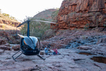
...click/tap to read the full postLake Argyle - A birds eye view (Lake Argyle, Western Australia)
Journal entry for Wednesday 29th May, 2019 (day 93, kms 283)
We took an early morning hike before leaving Limestone Gorge and captured a few more pictures of Boab trees (which we learned from a nearby plaque probably arrived in Australia from Madagascar on ocean currents). Then retraced our route over the rough entry track.
...click/tap to read the full postA day on Lake Argyle (Lake Argyle, Western Australia)
Journal entry for Thursday 30th May, 2019 (day 94, kms 0)
We spent most of the day cruising Lake Argyle. The cruise started at 11:30 and did not finish until 5:30 about 30 minutes after sunset. In terms of what we saw; rock wallabies clinging to the red cliffs, archer fish bombarding our hands to get the bread we were holding, lots of birds, and a few fresh water crocodiles. The cruise was topped off with a swim at sunset and the novel experience of trying to drink champagne while swimming.
...click/tap to read the full postRest day (Lake Argyle, Western Australia)
Journal entry for Friday 31st May, 2019 (day 95, kms 0)
We declared today a rest day and hung around the Argyle Resort. For me that meant a chat with neighbours, catching up on my audible novel and coffee (and cake) at the Resort restaurant. For Nina it was a walk on one of the resort hiking trails and some photos of the resort Infinity Pool.
...click/tap to read the full post