Posts for category border
Across the border (Baja Seasons, Mexico)
Journal entry for Monday 24th Dec, 2012 (day 173, miles 17,367)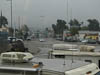
We were both pretty relaxed as we headed south east towards the border town of Tecate for our long planned entry into Mexico. What a contrast to the nerves we experienced back in June 2009 when with Norm (our guide) we entered via McAllen, TX for the first time.
...click/tap to read the full postCabo, cousins and some time at the beach (Los Barriles, Mexico)
Journal entry for Friday 4th Jan, 2013 (day 184, miles 18,656)
We had arranged to meet a cousin of Nina's this afternoon so we had time for a relaxed morning. We started the day with a drive through downtown Cabo which required some careful maneuvering through narrow streets and under low hanging trees, before heading west towards San Jose del Cabo. Along the way we stopped at Chileno beach for an hour or so to catch some sun. The beach was well looked after, the area was clean and tidy and well maintained restrooms were provided. There was a policeman in the parking lot presumably to ensure that things stayed orderly.
...click/tap to read the full postThe Northern Route - Day 3 (KM 245, Mongolia)
Journal entry for Tuesday 25th Jun, 2013 (day 83, miles 6,143)
It was raining steadily this morning as we got underway and continued that way for most of the day. The route this morning headed towards a town called Tsetseleg (same name as a previous town, but not the same town). At one point we seemed to be off course but a spur road took us back to the main track. A highlight of the morning was the appearance of 3 SUVs heading the other way. Also, at our morning tea stop we were visited by a couple of local guys on a small motorcycle, we invited them in to the camper to share our morning tea.
...click/tap to read the full postMountains and bikers (Tolbo Nuur, Mongolia)
Journal entry for Thursday 4th Jul, 2013 (day 92, miles 6,692)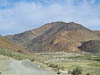
From last nights camping spot the road climbed through a series of river valleys over increasingly rough road or tracks to the highest point so far on this trip, 8660'. Along the way we passed through a couple of small villages and saw the inevitable herds of cows, sheep, goats, and camels. Late in the morning we were waved down by a pair of young boys who were out patrolling their herds on horse back. We were a little surprised that one of them spoke reasonably good English. Among other things he told us that he was "Kazak not Mongolian". We gave them some treats we carry for just such an occassion - immediately he asked (via sign language) if we had something to drink. We gave him a carton of fruit juice to which his response was - "one for my friend". He will be a successful animal trader some day.
...click/tap to read the full postRussians on vacation (Katun River near Manzherok, Russia)
Journal entry for Thursday 11th Jul, 2013 (day 99, miles 7,105)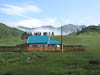
We started our travels today in, and after, some heavy rain falls but quickly the clouds cleared away and another nice summers day appeared. The road (we are traveling is the M52 which for the past two days was also called the Chuisky Trakt) continued to follow river valleys and wind between rounded mountains. As the day progressed we saw more signs of Russian tourism and Russians with vacation toys or camping gear on the tops of their cars.
...click/tap to read the full postA walk into the Canyon (Almaty, Kazakhstan)
Journal entry for Friday 26th Jul, 2013 (day 114, miles 8,578)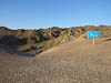
This morning before heading back towards Almaty Nina got up early to walk down the Jeep road to the bottom of Charyn Canyon to the informal camping ground at the river. Like a slug I stayed in bed for a while but eventually I felt guilty enough that I got up and followed. The round trip took Nina 1 and 1/2 hours and I only caught up to her 100m from the truck. Either Nina is getting faster, or I am getting slower. It was a pleasant walk as the valley through which the track passes was in shade for most of the time. We also discovered why the rangers warned us not to drive this track; at one point the track passes under a couple of big bolders and has no more the 7-8 feet of clearance.
...click/tap to read the full postLake Issyk Kul, saved from the police (Issyk Kul, Kyrgyzstan)
Journal entry for Saturday 3rd Aug, 2013 (day 122, miles 8,904)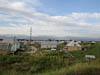
We got an early start this morning in order to avoid the the traffic and the police as we headed east out of Bishkek towards famous Lake Issy Kul. The plan largely worked and within 40 minutes from the hotel we were out of the city and on highway A365. We did not entirely avoid the police as we passed a number of radar traps and random stop but today we did not seem to be on anyones menu.
...click/tap to read the full postAfter effect of something; maybe the corn (Issyk Kul, Kyrgyzstan)
Journal entry for Sunday 4th Aug, 2013 (day 123, miles 8,974)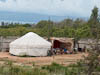
Today was a bit of a bust. I woke with a moderate tummy upset and headache that persisted all day. I put it down to the corn we bought yesterday from a roadside vendor. It was either simply too much corn (2 large cobs) or maybe the corn spiced with some local micro-organisms; though Nina suffered no bad effects.
...click/tap to read the full postAn explorer, torpedoes, and Polish travelers (Issyk Kul, Kyrgyzstan)
Journal entry for Monday 5th Aug, 2013 (day 124, miles 9,102)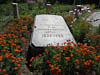
Much to Nina's relief I was back on deck this morning so we set off early for a full day of experiencing the delights and the unexpected of traveling.
...click/tap to read the full postKyrgys at play in a salt lake (Beside the A367, Kyrgyzstan)
Journal entry for Tuesday 6th Aug, 2013 (day 125, miles 9,238)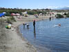
A hair cut and a quick swim in our small lake started the day and then we took our leave from our new Polish friends and were on our way. A little way down the road we passed 3 convoys of Mack trucks carrying fuel and led by Ford F series pickup trucks heading to a local gold mine operated by a Canadian company. At about the same time we passed a complex of walls and buildings that were amazingly decorated. The main wall seemed to have immitation yurts embedded at regular intervals, an eleborate gate and other amazing features. Noone seemed to be at home in the structure and we could not for the life of us work out what it might be.
...click/tap to read the full postOther overlanders in Osh (Gul'Cha, Kyrgyzstan)
Journal entry for Saturday 10th Aug, 2013 (day 129, miles 9,740)
We were up and going early this morning hoping to cover the 135km to the city of Osh by lunch time in order to have sufficient time to do some extensive grocery shopping. The drive this morning continued like yesterday afternoon. Cultivated fields everywhere, people selling all kinds of vegetables and fruits at roadside stalls. In many of the stalls people were still in bed as we passed; thats right they actually had beds in the stalls and we saw people still asleep in some of them.
...click/tap to read the full postOur highest point (Before Murghab, Tajikistan)
Journal entry for Monday 12th Aug, 2013 (day 131, miles 9,949)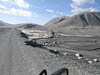
Today we crossed what we believe will be our highest point on this years journey, Ak-Baital Pass at 4655 meters (15,272 feet). But equally we spent almost the entire day traveling at over 4000 meters (13,125 ft). Only at the end of the day as we neared the town of Murghab did our GPS register an elevation below 4000 m. Todays scenery was stark and spectacular. For most of our way the road ran through one river valley or another. Typically the valleys were very wide and filled with grey gravel, and surrounded by barren mountains of many colors, and then the bigger mountains topped off with snow and glaciers. The road was a mix of old pavement and stretches of gravel, but really surprisingly good considering where we were. Though like yesterday there were periodic signs that nature was fighting back and from time to time we encountered road sections that had washed away or were being eaten away by river flow. There were also signs of recent road works so we guessed some effort is made to keep this road open.
...click/tap to read the full postA day at Yashilkul (Wakhan Road, Tajikistan)
Journal entry for Wednesday 14th Aug, 2013 (day 133, miles 10,090)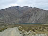
We spent most of today exploring the road out to, and beside, Lake Yashilkul. The gravel road that ran along the southern side of the lake gave good views and some interesting driving. Much of the day was overcast so we also spent a good deal of time simply sitting looking at the lake waiting for the sun to come out to provide better photo ops. It did sort-of.
...click/tap to read the full postThe Wakhan Valley Road - Day 1 (Zong, Tajikistan)
Journal entry for Thursday 15th Aug, 2013 (day 134, miles 10,158)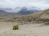
From our campsite near the junction with the Pamir Highway our route followed a heavliy washboarded road up a narrow valley, past a couple of very pretty lakes to Khargush Pass at 4255 meters before descending to the town of Khargush, a military checkpoint and the Parmir River and across the river - Afghanistan.
...click/tap to read the full postWakhan Valley - Day 3 (Khorog, Tajikistan)
Journal entry for Sunday 18th Aug, 2013 (day 137, miles 10,223)
After leaving Hanis guest house and Vali its friendly and helpful manager we set out down the Panj River valley towards Khorog. The scenery today was a bit like a combination of the previous two days driving. The Panj River valley narrowed and steepened and instead of a wide valley floor and a meandering river we had a narrow gorge (sometimes less than 100 meters wide), a raging river and steep valley sides with the road often cut into those steep sides as a shelf. Interestingly though even in this much steeper country the locals had managed to find patches of soil that could be cultivated and turned into house compounds or small villages. With the river much narrower we got some closer views of people and farms on the Afghan side.
...click/tap to read the full postAn outfit for Nina (Khorog, Tajikistan)
Journal entry for Thursday 22nd Aug, 2013 (day 141, miles 10,529)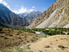
We had made arrangements to meet a young lady named Mehrafruz in Khorog today, so after a relaxed start to the day in beautiful sunshine we covered the last few kilometers into Khorog and parked in the main street. Along the way we passed, and were passed by, a car decked out for a wedding - in the photos below note the wedding car getting gas from a roadside vendor.
...click/tap to read the full postThe road - again (Kalaikhum, Tajikistan)
Journal entry for Saturday 24th Aug, 2013 (day 143, miles 10,689)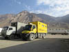
Today was about the road, views of people and activity on the Afghan side of the border and other travelers. But before getting underway this morning we had a number of curious truckers who wanted to know who we were, what we were doing and about the truck, of course.
...click/tap to read the full postGood road finally (Kalaikhum, Tajikistan)
Journal entry for Sunday 25th Aug, 2013 (day 144, miles 10,851)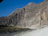
We got an early start this morning, after saying goodbye to our Swiss friends. We were on the road by 7:00am. According to our map we would follow the Panj River for another 100 km and then finaly head away from the river cross country towards Dushanbe. It is hard to believe that we have been following this same river (except for our side trip up the Gunt) since the town of Langar and our first day on the Wakhan. In other words we have driven beside the Panj river for 4 1/2 days, and to give some indication of the state of the road we have averaged less than 20 km/h on each of those days.
...click/tap to read the full postMore river canyons (Urmetan, Tajikistan)
Journal entry for Friday 30th Aug, 2013 (day 149, miles 11,019)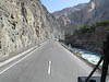
Our route North this morning along the M34 was more spectacular canyon, and thankfully good road. We noticed electrical transmission towers situated high up on the steep walls of the valley and we spent some time discussing how they would have been erected.
...click/tap to read the full postFinding the border (Buston, Tajikistan)
Journal entry for Sunday 1st Sep, 2013 (day 151, miles 11,151)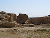
Our mission today was to find "the" border crossing into Uzebekistan. Even when we were back in Gig Harbor planning this trip with all the resources of google available to us we had trouble understanding the convoluted border line between Uzbekistan and its neighbours and now that we are "on-site" it is no clearer; infact maybe even less so as the 4 maps we have of this region (3 paper and 1 electronic) show quite different road networks across the border between Tajikistan and Uzebekistan. So todays mission was to sort this out and by the end of the day know our way to a border crossing.
...click/tap to read the full postThe Uzbek border crossing (Buka, Uzbekistan)
Journal entry for Monday 2nd Sep, 2013 (day 152, miles 11,198)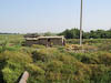
Crossing the border from Tajikistan into Uzbekistan was a long drawn out affair, so dear reader please bare with me it is going to take a while to tell this story.
...click/tap to read the full postEscape the heat (Zarmin dam, Uzbekistan)
Journal entry for Tuesday 3rd Sep, 2013 (day 153, miles 11,300)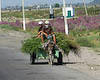
This morning when we woke all our hosts of last night had departed and the place was silent, cool, and deserted. We took advantage of the morning peace and cool to prepare for the day with the usual myriad of chores.
...click/tap to read the full postBukhara here we come (Navoiy, Uzbekistan)
Journal entry for Saturday 7th Sep, 2013 (day 157, miles 11,537)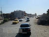
This morning we packed, said our goodbyes and were in the truck trying to navigate our way along the rough and busy Penjikent road towards the Samarkand ring route by 8:30. The first of our "on the road" chores was to try and find some diesel fuel. Fuel of any description is scarce in Uzbekistan as they have no oil supplies of their own and diesel and petrol/gasoline/benzene is all imported. Most local vehicles are running on compressed gas of some form which is much cheaper and more readily available as Uz has ample domestic supplies of natural gas. Fuel stations are an interesting sight, there are many derelict stations along the highway and also many new stations under construction. Of the ones that are established and appear working, many are actually closed as they either have no fuel to sell or are only selling it to locals. Thus we felt very fortunate this morning when we managed to buy 50 liters of diesel at 2800 soms per litre (US$1.07 per litre or just a little over $4 / gal).
...click/tap to read the full postThe desert (Kyzylkum, Uzbekistan)
Journal entry for Wednesday 11th Sep, 2013 (day 161, miles 11,717)
Now we are headed for Khiva and we have 2 nights on the road. Not far out of Bukhara the country side changed to low brush and sand to signal that we are truely in the Kyzylkum desert. We are both pleased to see that the weather forecasts we have been reading for the past couple of days are accurate and that the temperatures have moderated. Thus even though we are in the desert with no shade in sight the day is pleasant and the temperatures peaked at 85°F. The past few days in Bukhara the maximum temperature was well over 100°F.
...click/tap to read the full postMTV (Ayaz qala, Uzbekistan)
Journal entry for Thursday 12th Sep, 2013 (day 162, miles 11,870)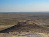
We had a rare treat today; really good road. Not long after getting underway this morning the road transformed from broken down tarmac to nice new concrete and more over it continued for much of the days drive. Apparently a German company has been contracted to build a modern concrete 4-lane divided roadway. So far only 2 of the 4 lanes are open but never the less those two lanes were drivers heaven. Just to remind ourseves that it is possible we had a brief burst of travel at 110 km/h (70 mph).
...click/tap to read the full postLow wires and the walled city (Khiva, Uzbekistan)
Journal entry for Friday 13th Sep, 2013 (day 163, miles 11,932)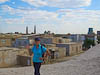
Today we got another lesson regarding the disadvantages of tall vehicles. The good German road of yesterday was no where to be seen as we wound our way over rural roads back to the main E40 highway, and then along a very rough road to Urgench the largest city in the area. Fortunately Urgench has a ring route that was evident on our GPS map and so we were saved the struggle of navigating the center of the city. From Urgench to Khiva the road was very good except for the fact that an electric trolley bus service operates on that road and the overhead wires that provide power to the buses vary in height from 5+ meters (which is plenty high enough for our truck to clear) to under 3 meters (which is defintely NOT high enough for our truck). So we had an interesting 20 km drive into Khiva trying to avoid low electrical wires and other traffic.
...click/tap to read the full postKhiva sightseeing (Khiva, Uzbekistan)
Journal entry for Saturday 14th Sep, 2013 (day 165, miles 11,932)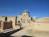
Yesterday afternoon at a local super market we met a local English speaking guide (he helped us figure out the check out procedure). During the course of this morning we arranged with him by phone and sms to have a tour of the highlights of the old city.
...click/tap to read the full postAral Sea - Part 1 (Aral Sea, Uzbekistan)
Journal entry for Tuesday 17th Sep, 2013 (day 167, miles 12,062)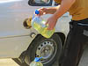
I am sure that most people know of the Aral Sea, a large body of previously fresh water that has been steadily disapearing since the 1960s. It is famous (or maybe infamous) as a stark example of environmental mismanagement resulting from the introduction of large scale cotton farming and associated massive irrigation on Uzbekistan territory during Soviet times. We were here to see this "wonder of the world" and to do so "while it is still there" - as the Lonely Planet guide book suggests.
...click/tap to read the full postFrench Fries in Dashogus (Dashogus, Turkmenistan)
Journal entry for Friday 20th Sep, 2013 (day 170, miles 12,152)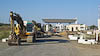
Tonight in Dashogus we had dinner at a local hotel and french fries were on the menu so I could not help but order some as we have not had, nor even seen, french fries since we left the USA nearly 6 months ago. They were not great, but still a treat. So now I should go back and start at the beginning of the day.
...click/tap to read the full postTraffic Police and the Devil's Gate (Devils Gate, Turkmenistan)
Journal entry for Saturday 21st Sep, 2013 (day 171, miles 12,337)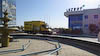
Our guide turned up at the agreed time, with a GSM chip for my phone as promised and we set off towards the no-longer existing town of Davaza (Derweze) about half way to Ashgabat. According to our guide book the town no loner exists because the previous president decided he did not like it and had it "removed". So if it does not exist, why go there? Well it is famous for a man made wonder called Devils gate, but we will get to that.
...click/tap to read the full postThe Mog in sand and more craters (Ashgabat, Turkmenistan)
Journal entry for Sunday 22nd Sep, 2013 (day 172, miles 12,515)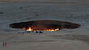
During the course of yesterday afternoon I started to think (fear?) that the sandy track we had traversed on the way in to view the crater yesterday afternoon may not be as easy to get over on the way back. There was one good sized sand dune along the track, and on the way in the track up to the top of that dune had a hard base but the track down was very soft. On the way out the soft part of the track would be up hill and I was concerned it would give our mighty-mog some trouble. As it turned out I was correct and I struggled for some time trying to climb the dune in the soft sand. My struggle was amplified by a few locals who insisted on reversing down the same hill I was trying to climb at the time I was trying to climb it and forcing me to avoid them. Eventually a more judicious selection of route overcame the problem and we were back on the highway.
...click/tap to read the full postHot desert (Kermen, Iran)
Journal entry for Saturday 28th Sep, 2013 (day 178, miles 13,209)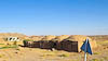
We got going early this morning in the hope of getting close to Kerman by the end of the day, and also in hope of covering a good distance before the days heat was upon us. As it turned out we covered a lot of distance and finished the day within 80 km of Kerman but we did not really escape the heat as during the middle of the day we crossed some really spectacular desert country (called the Dasht-e Lut) complete with heat haze, drifting sands and temperatures of 100°F. Again we lamented the demise of our trucks air conditioning system.
...click/tap to read the full postThe Kaluts (Dasht-e Lut, Iran)
Journal entry for Sunday 29th Sep, 2013 (day 179, miles 13,376)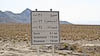
The first leg of the days travel was a pleasant mountain descent that brought us to the main highway into, and about 35 km from, Kerman. There we were confronted by another no-truck sign and an indication that we should take a western ring road around the town. We were a bit perplexed by this as none of our maps, even the GPS map, indicated that this ring road existed. We followed this for some time as it made a very wide detour and eventually linked up with another major highway running west out of Kerman towards the city of Yazd. Again no-truck signs seemed to bar our entry to (or even bypass of) the town.
...click/tap to read the full postMahan, a quick visit (South of Rafsanjan, Iran)
Journal entry for Monday 30th Sep, 2013 (day 180, miles 13,566)
After a few more photos we started early on our return trip from the Kalut in the hope of covering some of those kilometers before the sun got hot. The climb back over that mountain range seemed longer on the return and as on yesterdays drive the altitude moderated the temperature. So we stopped for a break at the summit and spent a while simply enjoying the cool air.
...click/tap to read the full postTroglodites (South of Yadz, Iran)
Journal entry for Tuesday 1st Oct, 2013 (day 181, miles 13,803)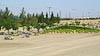
This morning we spent an hour or more searching for the town of Maymand. The group of Iranians we spoke to two nights ago at the Kaluts told us that this town was a must see, so there we were, or maybe there we were not. The town was not mentioned on any of our maps, that was a good start. From the Lonely Planet Guide we found that it was north east from the town of Shahr-e Babak. So here we were this morning driving through the Shahr-e Babak with no sign (or signs to) Maymand.
...click/tap to read the full postOur Shiraz Odessey - Episode 1 (Shiraz, Iran)
Journal entry for Tuesday 8th Oct, 2013 (day 188, miles 14,122)
My previous post at Iran Update gave a mere notification that we had some vehicle problems. It is about time I tried to bring everyone up to date on our Shiraz Odessey.
...click/tap to read the full postOn the road again (Road To Esfahan, Iran)
Journal entry for Sunday 27th Oct, 2013 (day 207, miles 14,468)Our truck is fixed (we hope) and it is time to get back on the road. Today we headed towards Esfahan about 450 km away. We maintained a moderate pace and checked the wheel hubs a number of times to make sure that the newly repaired hub was not getting hot. The good news - it seemed OK.
...click/tap to read the full postJewel of Iran (Esfahan, Iran)
Journal entry for Monday 28th Oct, 2013 (day 208, miles 14,531)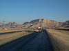
Once having completed checkin formailities and parked ourselves I set about draining the oil from the newly repaired hub. Every one in Shiraz told me I had to do this and in truth I wanted to see how much metal had accumulated on the magnetic drain plug. A large accumulation would indicate a likely problem with the most recent repair. The outcome was a modest amount of metal debris on the magnetic plug. So we are probably OK, but I will check again in a few days.
...click/tap to read the full postFirst snow (Hamedan, Iran)
Journal entry for Wednesday 30th Oct, 2013 (day 210, miles 14,819)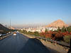
Today really brought home to us that winter is just around the corner. Some how the change in weather just snuck up on us as only 3 weeks ago we were trying to stay cool and complaining about the truck airconditioner not working. Whereas this morning as we prepared to depart Esfahan the sun was not up until 7:00am and the morning was cold, temps in the low 40°F. Later in the day as we drove north and a little west into the edge of the Zagros mountains we saw a dusting of fresh snow on the peaks and the temperatures in the valleys were sometimes only in the 30°Fs.
...click/tap to read the full postTakht-e Soleiman (Takht-e Soleiman, Iran)
Journal entry for Thursday 31st Oct, 2013 (day 211, miles 15,036)
We tried for an even earlier start this morning being on the road and moving even before the sun had poked its face over the horizon. An effort on our part to get past/through the town of Hamedan before the traffic got really crazy.
...click/tap to read the full postA driving day (Near Gilvan, Iran)
Journal entry for Friday 1st Nov, 2013 (day 212, miles 15,149)
The next, and penultimate, leg of our Iran journey is to the village of Astara at the very northern end of Irans Caspian Sea coast. Our guide Hossein R (the one who oranized the vehicle entry to Iran) lives there and he has invited us to spend a night with him before we make the trek together to Bazargan and the Turkish border. We are to meet Hossein at Astara on Sunday night so we have two days to get to and explore a bit of the Caspian Sea coast.
...click/tap to read the full postRain! (Masule, Iran)
Journal entry for Saturday 2nd Nov, 2013 (day 213, miles 15,272)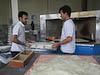
When we woke this morning the mountains around us were shrouded in cloud and by the time we got underway that had turned into a light rain forshadowing the rest of the day. This (the rain) was such an unusual occurrance that Nina and I spent some time discussing the question of "when was the last time we had rain" - our conclusion was Almaty, Kazakstan.
...click/tap to read the full postA visit with Hossein (Canrood, Iran)
Journal entry for Sunday 3rd Nov, 2013 (day 214, miles 15,382)
After retracing yesterdays sidetrip into Museuleh we got back onto the main coastal road heading north towards Astara and the border with Azerbaijan. This road was not memorable for any good reason, pretty much the Iranian version of strip developement being small villages with crowded mains streets every couple of kilometers, continuing rain and no view of the Caspian see. What we did see apart from lots of trucks and crazy drivers were lots of rice fields. This area is famous (in Iran) for the rice it grows.
...click/tap to read the full postIran, the final leg (Tabriz, Iran)
Journal entry for Monday 4th Nov, 2013 (day 215, miles 15,571)
Today began the final leg of our visit to Iran which was to be a circuitous route to the border at Bazargan with the prospect of some interesting sights along the way. To our pleasure and relief the rain was gone when we woke and we got under way in bright early morning sunshine. From Hossein's place at (or just below) sea level we climbed into the coastal mountains through some spectacular forests and switchbacks to over 7000ft before arriving on the outskirts of the town of Ardabil.
...click/tap to read the full postA bit of a shambles (Khoy, Iran)
Journal entry for Tuesday 5th Nov, 2013 (day 216, miles 15,774)
Before getting underway today we took a taxi ride into the city of Tabriz to see the famous blue mosque and the city's bazaar. The blue mosque is no longer blue, it gets its name from the fact that when it was built in 1464 it was decorated inside and out with tiles in various shades of blue. The mosque was destroyed by an earthquake in 1773 and the ruins remained untouched until a recontruction effort started in 1953. Today there are only some small patches of the orginal decoration. One of the interesting features of the mosques reconstruction is the way some of the tile decoration has been extended. Gaps left by missing original tile decoration has been filled in with plaster and the plaster painted to replicate the orginal pattern but in a slightly lighter color. This means that visitors can get the effect of the full sized original decoration but can see clearly where the original finishes and reconstrution starts.
...click/tap to read the full postThe border (Dogubayazit, Turkey)
Journal entry for Wednesday 6th Nov, 2013 (day 217, miles 15,907)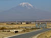
After a very early start we met Hossein at the entrance to Bazargan about 9:45am and the chaos of the Iran side of the Turkey-Iran border got underway. The first issue to be faced was actually getting into the border post. In typical Iranian fashion the entrance gate was competely blocked by taxis and other vehicles that were applying the standard practice of "park anywhere regardless of the trouble it causes". In addition the officers at the entrance wanted us to use the truck entrance and took a little bit of convincing that we infact were not a truck.
...click/tap to read the full postInernet and cheese finally (Lake Van, Turkey)
Journal entry for Friday 8th Nov, 2013 (day 219, miles 15,982)We spent all of yesterday at Larelzar Campground just catching up on chores and generaly vegin-out. Today we spent some time in the town of Dogubayazit mostly looking for an internet cfe that had wifi so that we could connect with our own computer. There must be a dozen internet cafes in a 2 block area of this town however all but one of them has no wifi, they cannot connect a laptop via their wiring and their computers all work in Turkish. Eventually we observed that the customers of these establishments are almost exclusively local boys.
...click/tap to read the full postCappadocia (Goreme, Turkey)
Journal entry for Monday 11th Nov, 2013 (day 222, miles 16,629)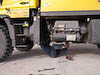
We started the day in mountain mist but that soon lifted and we were treated to a nice sunny day. It is always a little surprising how bright sunshine lifts the mood a bit. However, as you can see from the photos we had, in addition to the sunshine, a little work to do on the truck today. I discovered this morning while doing by irregular inspection that some bolts were loose and needed tightening. Fortunately we found an abandoned gas station which had a nice concrete driveway with a cover in which to work.
...click/tap to read the full post(Kas, Turkey)
Journal entry for Sunday 24th Nov, 2013 (day 235, miles 17,189)
There was still a bit of last nights rain and sour weather around this morning as we set off west from Antalya. Magnificent roads and magnificent scenery was the order of the day as we wound along the coast squeezed between the escapments of the Olympos Mountains on one side and the Mediterranean on the other.
...click/tap to read the full postLunch date (Kas, Turkey)
Journal entry for Sunday 1st Dec, 2013 (day 242, miles 17,190)
We had planned to get on the road today but a last minute invitation to a Thanksgiving lunch from some fellow travelers put paid to that. We spent the morning preparing and packing and then took the yellow beast about a kilometer up the hill to our luncheon appointment. Our hosts were Brett and Sandy a Californian couple who have been traveling in Europe in their pickup and camper and have decided to stay a while in Kaş and have rented an apartment up on the hillside a little out of the main street. At lunch with us were Barbara and Peter the Swiss couple we met in Tajikistan and who are staying in the campground we just departed.
...click/tap to read the full postBack into the mountains (Pamukkale, Turkey)
Journal entry for Monday 2nd Dec, 2013 (day 243, miles 17,371)
So today we did get underway again. For a while the road followed the coast and we got some great views of the Mediterranean and the numerous tourists and other sea side residential developments. As you might be able to tell we are finding the Med coast very pleasant and still marvel at how blue and clean the water looks.
...click/tap to read the full postTravertine marvel (Somewhere along the road, Turkey)
Journal entry for Tuesday 3rd Dec, 2013 (day 244, miles 17,440)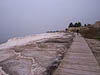
We were up and going promptly this morning as we were keen to explore. However our first problem was bare feet. The main entrance to the thermal area and ruins from the town of Pamukkale starts in the village main area and ascends across the travertines (mineral deposits) on the hill side. To protect those deposits from the hordes of visitors one is required to walk across the travetine in bare feet. Now us old guys are beginning to feel the effects of age and skeletal deterioration and hence bare feet are not our forte. So after some negotiation with the entrance staff we were allowed onto an alternate path that took us to the top of the hill. However as you will see later this did not entirely get past the bare feet topic.
...click/tap to read the full postThe ruins of Ephesus (Ozdere, Turkey)
Journal entry for Wednesday 4th Dec, 2013 (day 245, miles 17,511)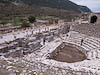
After our night with the trucks we set out in overcast and rain to find our way to the town of Selcuk and the famous nearby ruins of Ephesus. The roads were good the scenery pleasant and we eventually found our way into the main street of Selcuk.
...click/tap to read the full postA travel day (Bergama, Turkey)
Journal entry for Thursday 5th Dec, 2013 (day 246, miles 17,616)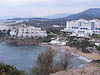
Today was a travel day. We spent a deal of time winding our way along the coastal road and then through the city of Izmir (according to the Lonely Planet the 3rd largest city in Turkey). The route through Izmir took us along the water front; it looked really inviting with the bright sun, blue water, promenade and gardens but with no obvious places to stop we only admired it from the truck cab. The city seemed to stretch for miles as the road passed through one community after another. This gave us an opportunity to admire the way the Turks have put modern roads through old towns. As it passes through a congested shopping or market area inside a town the road is made up of three pieces, the center lanes are for through traffic and there is a lane on each side for local traffic. At intersections the through-road simply goes under the intersection with a well signed 4.8m clearance.
...click/tap to read the full postBergama and the Ruins of Pergamum (Burhaniye, Turkey)
Journal entry for Sunday 8th Dec, 2013 (day 249, miles 17,686)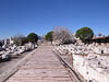
As you can see from the date on this entry we have skipped a few days. We spent those days hold up in the caravan ground at Bergama. There is not much to say about those days except perhaps that the weather varied between bright winter sun and howling wind and rain. Night time temperatures below freezing as indicated by the ice on the ground in the morning. Today we are on our way again with a visit to Pergamum, the local Acropolis (fort on a hill) and the center of the old city of Bergama
...click/tap to read the full postCountry villages and narrow roads (Burhaniye, Turkey)
Journal entry for Monday 9th Dec, 2013 (day 249, miles 17,686)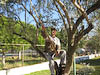
Today we are headed for the old city of Troy and since the days route seemed to be relatively short we chose to follow the coastal road as much as possible. As a result we spent most of the day traveling along winding roads that pretended to be wide enough for two vehicles but in many places would not have fitted two of us side by side. We passed through small country villages with narrow streets, lots of tractors, herds of goats and olive trees and olive trees.
...click/tap to read the full postA visit to old Troy (Troia) (Burhaniye, Turkey)
Journal entry for Wednesday 11th Dec, 2013 (day 252, miles 17,805)
We have now been in the caravan camp at Troy for a couple of days and over that time the weather has been bright and sunny as well as wild and wet. This morning it is clear and very cold. There is some solid ice on the ground this morning and snow is being predicted for the Gallipoli Penninsula just a few miles away. Never the less today is the day we will visit the historic sight of Troy. But we will do it dressed in all the cold weather gear we have.
...click/tap to read the full postEurope! (Eceabat, Turkey)
Journal entry for Thursday 12th Dec, 2013 (day 253, miles 17,826)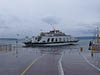
Today is/was a big milestone for our journey, we crossed the Dardanelles (Hellespont) to the Gallipoli Peninsula and into Europe. In all other ways the day was quite un-remarkable. This morning as we prepared to depart our camp at Troia there was light snow falling (though none was accumulating). There after a shortish hop took us to the town of Çanakkale (which we would learn is pronounced Chanakarley) and the ferry to Eceabat on the Gallipoli Peninsula.
...click/tap to read the full postExploring the Gallipoli Peninsula (Kilitbahir, Turkey)
Journal entry for Friday 13th Dec, 2013 (day 254, miles 17,896)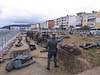
The weather was a little better this morning, though still not great, overcast with occassional showers. But we could not let the weather prevent us exploring the peninsula. From Eceabat we headed to the western shore which is where most of the sites of interest to Australians lie. First stop was a somewat run down information center which despite its need for some repairs effectively told the story on the background to and course of the Gallipoli campaign.
...click/tap to read the full postTo Istanbul (Selımpaşa, Turkey)
Journal entry for Saturday 14th Dec, 2013 (day 255, miles 18,093)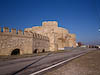
We were welcomed this morning by bright sunshine and blue sky. Before getting underway we spent some time walking along the water front enjoying the fabulous scenery before making a quick tour of the gun battery.
...click/tap to read the full postIstanbul - sort of! (Istanbul, Turkey)
Journal entry for Sunday 15th Dec, 2013 (day 256, miles 18,150)Well today was an adventure of back streets and low underpasses. Early on in the day we were feeling good, we left last nights camp in bright sunshine and got onto one of the many freeways heading into Istanbul and all seemed to be going well. Then we made a small navigation mistake by missing a fork in the freeway. But initially that did not seem too bad as our GPS quickly re-routed us and we started following the corrected route. But quite quickly this new route dropped off the freeway, into a crowded intersection and we found ourselves confronted with a 3.6M clearance sign. Fortunately we found our way past that one only to be confronted by one that read 3.8M and at this one there was no way out other than a long reverse through heavy traffic. Now remember our truck is actually 4.0M high. But I noticed that there was a slope on the road and that the clearance was greater on the left hand side of the road. Against Nina's protests I gingerly tried that higher side and squeezed through with no damage.
...click/tap to read the full postIstanbul (Istanbul, Turkey)
Journal entry for Monday 16th Dec, 2013 (day 257, miles 18,093)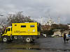
We pretty much got going with the sun this morning with the forlorn hope that an early start would help us avoid some of the heavier traffic. It did not seem to.
...click/tap to read the full postThe Tumulus and Phillip II's Tomb (Vergina, Greece)
Journal entry for Monday 30th Dec, 2013 (day 271, miles 18,587)
This morning we needed to find fuel and money so we used our trusty OSM map to pick a group of banks in the city of Thessoliniki and headed that way. Unfortunately the road system defeated us and we passed by our targeted banks on a limited access road with no way to get to our targets. A further check of the map identified a Shell station at the entrance to a small town called Chalastra so that was our next hope, and indeed it worked. Diesel for 1.355 Euro per liter (about $6.80/gallon). Also the owner would accept credit cards, spoke English and has a brother that lives in Canberra. We suspect we will meet a lot of people in Greece with relatives in Australia.
...click/tap to read the full postSome Greek country roads (Near Delhpi, Greece)
Journal entry for Tuesday 31st Dec, 2013 (day 272, miles 17,896)We departed our parking lot this morning in the rain and for a while continued south on the motorway paying tolls at regular intervals. But eventually our route and inclination took us onto some country roads and through rolling farm land. All in all an unremarkable day.
...click/tap to read the full postDelphi was closed (Delphi, Greece)
Journal entry for Wednesday 1st Jan, 2014 (day 273, miles 18,823)
As we drove those 40 km to Delphi this morning the road became increasingly narrow and twisting as we climbed into the mountains and had us wondering whether we would in fact be able to enter the town and get to the archaeological site and museum for which the town is now famous. With that concern in mind we parked right at the entrance to the town's main street and went exploring on foot. As it turned out modern Delphi's main street is actually two streets, one in each direction. They are both quite narrow and made even more so by the habit of locals and visitors parking down each side of the street. But never the less it seemed likely we could get through; if tour buses can do it so can we. So after a tense 10 mintes passing by parked cars with literally inches to spare on each side we were on the other side of the town and parked in front of the Archaeological Museum. There, together with a smattering of other tourists we discovered that the museum was closed (it was after all New Years day).
...click/tap to read the full postDelphi this time open and sunny (Athens, Greece)
Journal entry for Thursday 2nd Jan, 2014 (day 274, miles 18,939)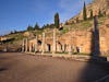
This morning the sun was out making a perfect morning for our visit to the ruins of ancient Delphi. There were only a handful of other tourists around as we climbed up through the ruins admiring the various buidings and other artifacts. Despite being a tourists mecca, and a bit of a cliche, the place was really quite impressive. Many of the more delicate statues recovered from the ancient site are now housed in the nearby museum and after our visit to the ruins we spent some time there admiring the masterful statuary (both stone and bronze). One could not help but wonder how much of our civilization will be visible in 3000 years.
...click/tap to read the full postFerry to Santorini (Athens, Greece)
Journal entry for Monday 6th Jan, 2014 (day 278, miles 18,939)
This morning we were awake at 4:45am in order to get to and catch our 7:30 ferry to the Greek Island of Santorini. The ferry ride took all day as the vessel made stops at a number of Islands as well as Santorini. The journey was uneventful, though a bit boring. But fortunately the sea was calm even though the weather was overcast.
...click/tap to read the full postPeloponnese (Xiropigado, Greece)
Journal entry for Friday 10th Jan, 2014 (day 281, miles 19,024)
We spent yesterday recovering from our overnight ferry ride and doing a bit of "getting underway" preparation so that this morning we could depart our friendly camp ground for the next stage of our Tour of Greece. Navigating was easy as we traveled out of Athens towards Corinth and the Island of Peloponnese.
...click/tap to read the full postA glorious day (Monemvasia, Greece)
Journal entry for Saturday 11th Jan, 2014 (day 282, miles 19,118)
Today was a glorious day, warm (60°F), sunny and with the bright blue Mediterranean and many picturesque villages to admire. We spent the morning simply enjoying the coastal scenery.
...click/tap to read the full postDiros Caves (Lobkadika, Greece)
Journal entry for Sunday 12th Jan, 2014 (day 283, miles 19,218)
We lazed around Monemvasia this morning enjoying the sun and doing a little exploring of the nearby village. But eventually it was time to get going so we continued our adventures on mountain roads and narrow village streets towards the west coast of Peloponnese to Areopoli and then a little south to the Dimos Caves.
...click/tap to read the full postA cute village (Near Sparti, Greece)
Journal entry for Monday 13th Jan, 2014 (day 284, miles 19,318)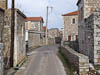
A prompter start this morning as the weather was not so inviting and we had more on our agenda today. First off we crossed back over to the west coast of Peloponnese, past Areopoli again and then north along the coast to the little village of Kardamyli. Nina had read/heard about this place from one of Rick Steve's tapes/books/shows. The people of the village apparently have worked hard to prevent over development. So after a lot more narrow roads and even narrower villages we arrived at Kardamyli.
...click/tap to read the full postNew friends and expedition trucks (Near Olympia, Greece)
Journal entry for Tuesday 14th Jan, 2014 (day 285, miles 19,477)This morning we continued east towards the town of Nafplio. Now anyone following our antics on Peloponnese will have noticed that this route takes us back almost to the start of our Peloponnese journey so the natural question is why?
...click/tap to read the full postAn unexpected meeting (Ancona, Italy)
Journal entry for Friday 17th Jan, 2014 (day 288, miles 19,568)Before getting on to todays report I want you to look at the photo of the green truck in yesterdays photos and note the seating position of the driver. We thought our Unimog was pretty smart with its variopilot which allows the steering wheel and pedals to be moved to the other side of the cab to make the truck right hand drive. Well the tug trucks that move trailers around the port of Patra go one better; they can actually turn the driving position around so that they don't have to reverse with mirrors.
...click/tap to read the full postFirst taste of European roads (Faenza, Italy)
Journal entry for Saturday 18th Jan, 2014 (day 289, miles 19,702)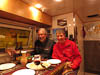
Once awake this morning we moved our vehicle back into the ferry waiting area and the catching up with Gary and Monika continued. In addition now in the light of day we could take a few photos of the twoadventure vehicles parked side by side. However eventualy it was time for the Wescotts to checkin for their ferry and for us to get on our way.
...click/tap to read the full postVenice across the water (Fusina, Italy)
Journal entry for Sunday 19th Jan, 2014 (day 290, miles 18,939)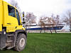
We had a rude awakening and a few sick moments this morning. Lying in bed half asleep I could hear the engine of a nearby semi-trailer and deduced from the noise that the driver was manouvering around some kind of obstacle. After a few moments I realized that the gray mass just outside the window over our bed was not fog but the side of a truck and then that is was only 2 inches from the window. Yikes; the driver was manouvering around US. I bounded out of bed with the intent of either sounding our horn of moving our truck. I got the engine started, bare foot down on the clutch pedal to engage the gear, and my left calf muscle screamed in anger with a cramp. You see I was too quick; the truck had not built enough air pressure to provide power assistance to the clutch and my still sleepy legs did not want the stress of pushing the un-assisted clutch.
...click/tap to read the full postThe alps, expensive roads (Muhlbachl, Austria)
Journal entry for Tuesday 21st Jan, 2014 (day 292, miles 20,063)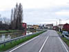
Today we planned to simply drive as far as we could in the hope of clearing the alps during a window of relatively good weather - you see we don't have snow chains for our trucks and hence we did not want to be in the alps during a storm. So we headed out towards Verona along the A4 and then north along the A22 towards the Brenna Pass and Austria.
...click/tap to read the full postFinding a camping ground near Munich (Munich (Langwieder See), Germany)
Journal entry for Wednesday 22nd Jan, 2014 (day 293, miles 20,198)Today we were looking for a camping ground on the outside of Munich. We wanted a place to park for two nights so that we could visit some Gig Harbor friends who are spending a year living in and experiencing the German lifestyle in Munich.
...click/tap to read the full postIt's 2:00pm, must be the Netherlands (Kasterlee, Belgium)
Journal entry for Saturday 1st Feb, 2014 (day 304, miles 20,704)Today we just drove, with the intent/hope of getting to a camping ground within easy reach of Antwerp by the end of the day. At one point during the day the road crossed a 20 km section of the Netherlands, we joked with each other that if it is 2:00pm - it must be the Netherlands. At this rate we could drive across the whole of Europe in a coupLe of days and see nothing except motorways.
...click/tap to read the full postDelivery and a lucky escape (Antwerp, Belgium)
Journal entry for Monday 3rd Feb, 2014 (day 306, miles 20,704)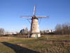
We spent yesterday preparing the truck for shipping. This mostly involved packing things away inside the vehicle out of sight and cleaning. We had been warned by the shipping agents ( Seabridge For Motorhomes) that Canadian customs will be fussy about dirt on the outside of the vehicle. So at Merex we had the outside thoroughly cleaned with steam and pressure washer but the drive since then (through the rain) had covered the vehicle with road dirt. So we both spent a few hours with broom and bucket cleaning said road dirt off.
...click/tap to read the full post