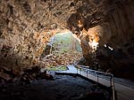
Lava Tubes Tour
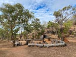
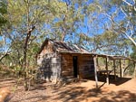
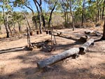
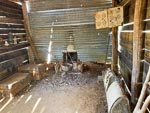
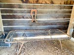
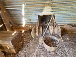
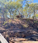
In 1862 Thomas and Charles Collins travelled beyond the blazed tree to claim new land. About 40km south of here one of the thirsty bullocks strayed. The sound of its bell drew the stockman to a spring fed creek. Recognizing the importance of permanent water they claimed 100 squre miles of surrounding country and named it Spring Creek Station. They built a hut similar to the one in the photos below.
The Collins family was one of the originals and they have worked lease-hold properties in this area from that time and at one point in the late 1990s they managed over 900 square km.
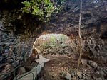
For many years the volcanism, and particularly the lava tubes, of this area were largly unknown. Though some of the lava tubes were known to aboriginals and some were permanent water sources that supported white incursions in this area.
In the mid to late 1980s the lava tubes gained noteriety, with expeditions of Australian academics and a NASA team visiting the area, and a documentary aired by the ABC. Eventually this lead to a large National Park being decalred that resulted in the Collins family loosing most of their lease-hold.
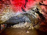
Undara NP has the destinction of having the longest Lava Tube in the world at approximately 100km in length. The formation of these tubes is a somewhat complex process (meaning I cannot easily repeat it), but requires a granite rock base (so that the lava cannot melt the rock it flows over), some water courses (creeks) so that the lava can buildup a deep section which will eventually be the route of the tube.
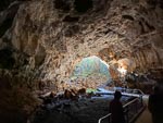
The park is closed to the public with access only via organized tours. The justification for this is two fold:
The roof of a lava tube can be fragile and there is a history of these collapsing suddenly when people or animals simply walk over the ground above a lava tube. These areas are not identifiable from the surface.
Some of the caves (even some of the tourist caves to which tours are regularly conducted) have a tendancy to experience concentrations of carbon-dioxide, up to 8% by weight. That concentration is lethal to humans. Local aboriginals were aware of this danger and their legends identify some caves as "homes of devils".
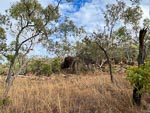
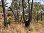
On a final historical note. In the late 1800s this area was the site of some frantic telegraph building as Queensland hoped that the telegraph lines from Indonesia would come ashore in the Gulf of Carpentaria and hence raced to build a telegraph link from the coast at Caldwell to Normanton. There are still remnants of that effort visible today. The most obvious are the Iron Bark Gum trees with forked trunks. In addition to felling local trees for telegraph poles the construction crews had to somewhat clear the area under the wires. They did this by cutting the forest at waist high. This killed many of the trees but not all. Some of the iron barks survived and regrew with forked trunks as seen in the photos above. Apparently you can follow the path of the old telegraph line by simply following the forked trees.