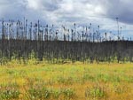
Oil sands and wild fire
We were a bit surprised to see that there was less traffic this morning as we completed the drive into Fort McMurray. Sunday does seem to make some difference to the pace of activity in this energy boom-town area. The big interests today were oil sands and the wildfire that devastated Fort McMurray earlier in 2016.


We started with a stop at the Visitor Information Center where we spent time examining their extensive display on the oil sands industry and extraction processes. Basically the oil deposits are in the form of sand grains encased in bitumen and to extract oil the bitumen must be heated with stream to be released from the sand grains. Interestingly much of this now seems to be done without actually mining the sand. They call this in situ recovery
Also at the Visitor Information Center we got a bit of a run down on the big fire earlier this year and in particular this link fire map where one can examine before and after satellite images of Fort McMurray.
If you want to use this fire map, find the big yellow panel on the left side of the page and click on "Fire map". On the next page make sure you scroll down to find the two arial photos.
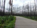
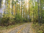
After the info center we took a drive around town and looked at a couple of the devastated areas. The town certainly lost a lot of accommodation and the rebuilding work seems to still be in its early stage with cleanup of the debris still underway. It was also surprising that the badly damaged areas seems to be just pockets of the overall town area.
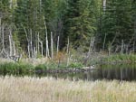
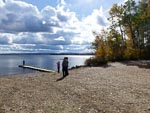
After out tour of the town we traveled south along highway 881 and found a camping spot at Engstrom Lake Provincial Recreation Area.