A few water crossings
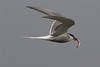
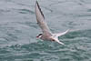
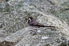
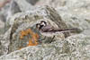
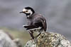
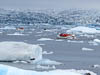
We had a second go at the ice/bird photo thing this morning as the light seemed better and from time to time seemed to promise that we might actually get some sun. But again this was a false promise so we added to our collection of somber images.
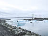
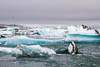
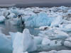
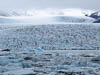
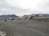
On the road again we continued west on Highway 1 past numerous impressive, large glaciers. The largest of these is called Skeidararjokull. The rivers that flow out of this glacier form a vast delta composed of black sand, glacier debris and old lava. While crossing this delta we saw an exhibit of the power of a glaciers when combined with a volcanic eruption. In 1996 an eruption caused the Sk glacier to flood it released vast quantities of water (the flow rate was estimated at 50,000 cubic meters per second - according to the exhibit) which carried blocks of ice weighing 1000-2000 tons. The twisted metal in the photo below is a piece of a massive bridge that was destroyed by the flood.
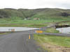
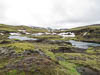
Our plan had been to head inland and into the mountains by following road 208 (and F208) to Landmannalaugar. But as we eventually discovered the F208 was closed by snow after about 40 kms. In the process of getting to the closure we traversed some rich looking farming country, some barren old moraines, some old lava beds and forded a couple of rivers. And then we got to do it all over again while retracing our route. Even so it was an interesting drive and confirmed to me that the mods we made to the truck in early 2014 (particularly upgraded shocks) has really improved its handling of rough tracks.
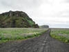
Just east of the town of Vik we took a side track out onto an expanse of black sand and gravel near a prominent headland. A nice isolated spot for our nights camp.